ROYAL NAVY HARBOUR DEFENCES - MANZA BAY, TANZANIA
ROYAL NAVY HARBOUR
DEFENCES - MANZA BAY, TANZANIA
 |
 |
 |
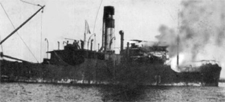
| Manza Bay - north heads | Kronborg - on fire in Manza Bay | Manza - Command Post |

| Manza Bay is located on the coast of Tanzania, some 16 km north of the town of Tanga. During World War I a German vessel called the Kronborg (actually the captured British vessel Rubens), on a mission to resupply the besieged SMS Königsberg, was sunk by the British ship HMS Hyacinth. During World War II, Tanzania's northern neighbour, the British colony of Kenya, was a temporary base of the British Eastern Fleet from early 1942 until the Japanese naval threat to Colombo and Ceylon had been removed. This is a story of the indicator loop defences at Manza Bay. Further information about Kenya can be found on the Mombasa Forts webpage. | 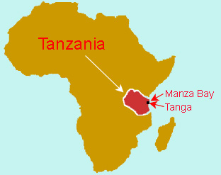 |
 |
If you worked there or have any feedback please email me: Dr Richard Walding Research Fellow - School of Science Griffith University Brisbane, Australia Email: waldingr49@yahoo.com.au |
 |
My thanks to Hans-Martin Sommer M.A., former Marine
Archaeologist, Fort Jesus Museum, Mombasa, Kenya for his assistance in providing
photos and some text for this webpage. Email: <sudanhansm@yahoo.de>. Hans-Martin has started
a project called: "Defense of Mombasa, 1485- 1945". The range of objects begins
from early Turkish and Portuguese fortifications and ends with many British
bunkers, tunnels and other fortifications and harbour defences.
Hans-Martin has previously worked in Germany, Spain, UK and Poland and
has published widely. He is a member of the British Institute in East Africa
and the Institutum Canarium. He is photographed here in 2006 at a bunker at Kipevu (Port Kilindini)
Mombasa. His evidence for indicator loop defences at Manza Bay adds to
the rich military history of Kenya and Tanzania. Thanks to Steve & Cathy Attwell (Tanga/Arusha, TZ), the owners of the nearby Fish Eagle Point for accommodation and transport, Robert Elder (Geita,TZ) for providing information. |
Indicator Loops - an overview (YouTube, 70 minutes)
|
|
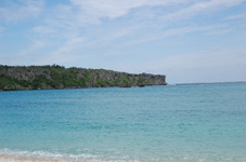
| Manza Bay, Tanzania |
MANZA BAY HISTORY
World War Two. In the mid 1930 activities began to defend the East African Coast, especially the harbors of Mombasa, Dar es Salaam Tanga and Zanzibar. Fearing attacks from the Italian Somali-land in the north as well from the sea-power axis nation Japan- Germany the coast line was heavily fortified. Six-inch guns and Anti Aircraft emplacements with the attached ammunition stores, search lights with underground generator rooms and even underwater loops to detect enemy ships and submarines were installed. Along the Kenyan and Tanganyika coast a chain of coast-watcher posts were erected.
A good summary of the strategic interest Britain had in British East African Territories was given in a radio broadcast by Major Sir Humphrey Leggett, D.S.O. on the Overseas Empire Transmission on Wednesday, 19th June, 1940. It was entitled: THE BRITISH EAST AFRICAN TERRITORIES AND THEIR STRATEGICAL IMPLICATIONS a few paragraphs referring to Tanzania (Tanganyika) are reproduced hereunder.
The territories under the British Flag in Eastern Africa, not actually in the active war zone, are now at any rate on the fringe of it, as you know from the daily mentions in the war news of places the names of which are unfamiliar to most of us. What are these territories, and who inhabits them? Firstly, the one nearest to the enemy is the Kenya Colony. Kenya for many years has voluntarily adopted compulsory liability for military service in the Local Defence Forces, and a system of annual training for all British men between the ages of eighteen and fifty‑five, and I think it has been stated in the newspapers that they have now been called up. They will very certainly give a good account of themselves when occasion arises.
I will not go into so much detail about the other British East African dependencies‑Uganda, Tanganyika and Zanzibar. They are more remote from the present fighting and have no enemy frontier. To the north of Uganda lies the Anglo-Egyptian Sudan, and on the west Uganda marches with another ally, the Belgian Congo. The Congo also forms the western boundary of Tanganyika to as far south as where Tanganyika joins the British territories of Nyasaland and Northern Rhodesia. On the east Tanganyika has 600 miles of coast frontage to the Indian Ocean, including the port of Dar-es-Salaam, the terminus of the railway linking that port right up to Lake Tanganyika about 700 miles from the sea, and there is a branch line from that main line to Lake Victoria. These railways provide a line of communication to the Congo, and an alternative route to Uganda and the interior of Kenya via Lake Victoria, should any mishap befall the railway from Mombasa to the interior. The three million Africans of Uganda and the four and a half millions of Tanganyika are loyal to a man. The British white population are smaller than in Kenya, but of the same quality. Germans and Italians have all been interned without trouble.
So that is the frontier, the outpost, as I have
said, of the whole of East, Central and South Africa, and I have tried to
describe to you the people to the south of it, who are pledged to defend it, and
what are the strategical interests they are defending.
At this time the Admiralty remembered the shipwreck of the Kronborg. From the end of December 1942 the wreck was used as a training-target for bombing and bombardment by ships of the Royal Navy. She lay there until September 1956 when the Italian salvage company Mawa Handels Anstalt began repairing the numerous holes in the hull - mostly resulting from the bombing exercises. After a seventy day salvage operation the ship was towed to Dar es Salaam by the tugs Simba and Nyati and the 1,600 tons of coal sold to East African Railways and Harbours and the hull broken up for scrap.
1. MANZA Harbour Defences
On 27th July 1939, the British Admiralty
finalised its minelaying program for ports at home and abroad for the early
stages of the war should it occur. The Admiralty policy was that minefields
should only be laid at the outbreak of hostilities and not before as the
cost of maintaining the mines and the minefield was prohibitively expensive.
Minefields were planned for Hong Kong, Singapore, Alexandria, Malta,
Tynemouth and Cromarty Firth. Upon outbreak of the war with Germany in
September (1939) the minelaying program began in earnest.
The following is a description of the
construction of fortification by the Royal Engineers by the officer in charge.
The Indicator Loop cables were installed, connected and operated by the Royal
Navy. The loop control hut and associated buildings (accommodation, power huts)
would have been constructed by local labour.
Reproduced in The Royal Engineers Journal,
Vol 108, No. 2, August 1994, pp 201-208.
The Navy had heavy demands for buildings for shore, headquarters, signal stations, temporary accommodation for ratings, and ammunition and stores of all kinds. Much of this was met by requisitioning public buildings such as schools, hotels and warehouses, but a great deal of modification was needed to meet full requirements. On the mainland to the north a leave camp was established for the thousands of sailors off the ships, to the south an armament depot in the bush adjoining Port Reitz was being constructed. The air forces (RAP, Royal Naval Air' Service, and South African Air Force) were not active on the island itself, but were developing a big new airfield on the mainland west of Port Reitz - which is today Mombasa international airport - where the South African Engineer Corps were, using such giant machines as we in East Africa had never seen before.I assumed responsibility for priority defence projects which included harbour defences of smaller guns, and searchlights covering both Kilindini Harbour and Mombasa Old Port, and linked to underwater detection loops installed and operated by the Royal Navy. I also took over responsibility from the second CRE for engineer works. along the East African coast from the border with ex-Italian Somaliland in the north to the Mozambique border in the south; in a previous appointment I had reconnoitered this coast extensively and reported on the most likely beaches for an enemy landing. I also became responsible for the installation of coast batteries at Tanga, Dar-es-Salaam and Zanzibar; for other minor works along the Tanganyika coast and on Zanzibar..' Island, and for the chain of coast-watchers up and down the Kenya coast. The main considerations dominating all these disparate and scattered works was the urgent need for speed, and the dire shortage of resources.
2. CONTROLLED MINEFIELD AT MANZA BAY
It wasn't until 1943 that the minelaying at
Manza began. The main consideration by the Royal Navy was to defend Manza
Bay against midget submarine and human torpedo attack. The initial idea in
February 1943 was to use Antisubmarine boom nets, indicator nets (nets with
carbide lamps that lit up if disturbed by a ship) and Harbour Defence Motor
Launches (HDML Patrol Craft) as a general measure as well as a
controlled minefield against midget submarines.
 |
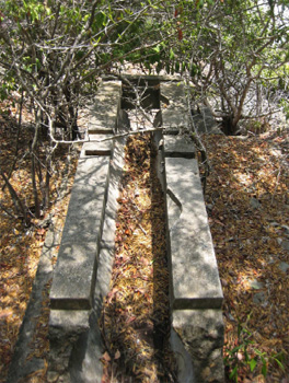
 |
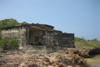
| The two Controlled Mining huts on Manza headland | Mavemaveli Rocks as seen between the two CM huts. |
|
As defence against human
torpedoes the Royal Navy planned to used three
Indicator Loops (3-legged type) for detection and two
Harbour Defence Asdics as a backup. It was soon decided to abandon the
defences against human torpedoes as it was felt that capital ships were not
in harbour long enough and to minimise the huge costs involved. Ultimately,
the Navy decided to go for a double Controlled Minefield with the associated
mine loops and guard loops. The guard loops at Manza Bay required 10.5 km of
18-core cable and the
mine loop a further 2.9 km of cable. The loops also needed 7.2 km of tail
cable. The mine cables themselves required about 2.9 km of cable. Personnel
would have been trained at the Controlled Mining School at HMS Vernon
(Portsmouth, England).
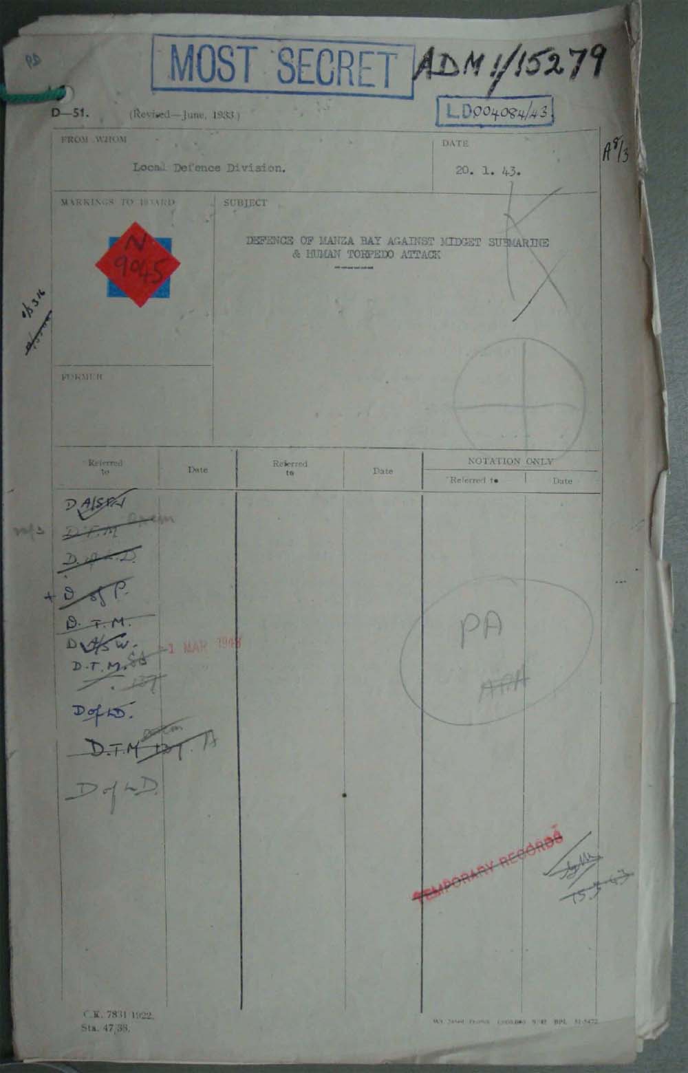
The document to the right is the cover page from the correspondence about the Manza Bay controlled mining taken from files in The National Archives, London. Click to see an enlargement. |
 |
|
Click to enlarge |
Each of the two mine loops was about 700 yds long by 25 yds wide with four buoyant mines moored in the centre and attached to a firing cable. There was a 160 yd overlap between loops. There were three guard loops of varying lengths: A = 3000 yds, B = 4600 yds, C = 2850 yds and all were 25 yds wide, and overlapping slightly. These were positioned about 3000 yds on the seaward side of the minefield. Tail cables (4 core, as shown later) ran from each of the five loops to the shore and thence underground to the naval mine watch station. Guard Loop C was watched from a control station on the southern shore. The associated amplifier was the new Photovoltaic Amplifier Mark 1 (PVA). In 1945 - at war's end - the Royal Navy may have exploded the mines if attempts to recover mines and sinkers was unsuccessful because of lack of power in the mine recovery winches; alternative they would have been recovered and destroyed. In other RN controlled minefields throughout the world the mines were also generally detonated and sometimes attempts at recovering the cables were made. In some countries only 50% of the cables were lifted as they were more likely to be covered in mud, sand or coral and after five years in the salty water the condition was usually poor. The layout of the minefield is shown below.
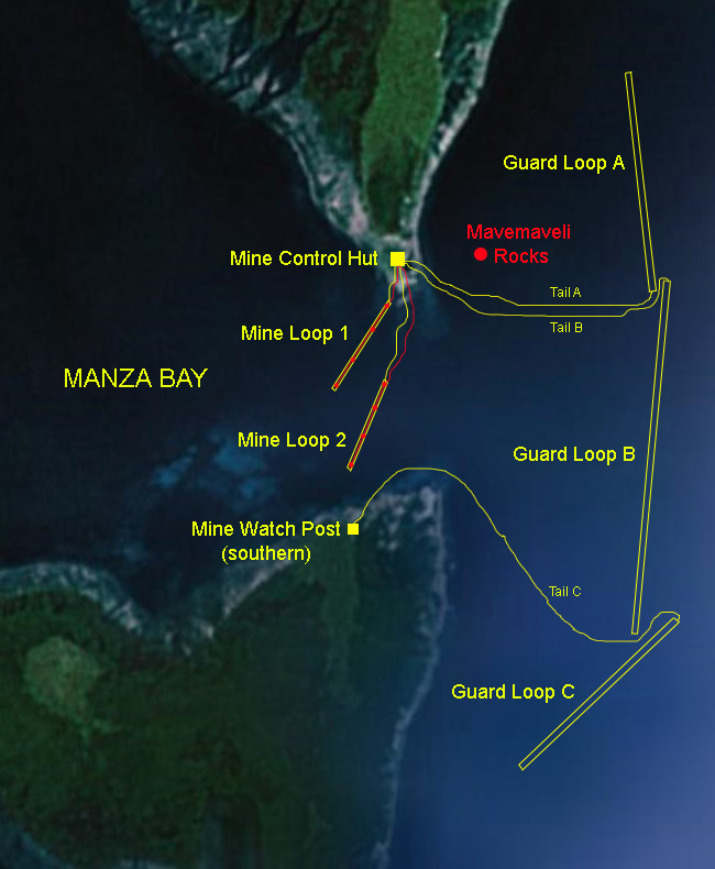 |
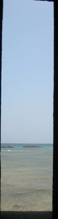 |
| Map of Manza Bay with locations of naval defences | Mavemaveli Rocks from the Mine Station window. |
3. OPERATION OF
The Extended Defence Officer's POST & Mine watching STATION.
The Extended Defence Officer (XDO or EXDO)
was the naval officer responsible for all naval activity in a given area. He
had the responsibility for the minefield, boom nets, indicator nets and
signals and was the liaison between the RN and army at north head. If the
XDO's visual sightings and communication with the army revealed the likely
presence of an enemy U-Boat, the XDO would give orders to the mine watch
officer on duty. The orders and firing sequence were the same throughout all
CM stations around the world. The men in the Mine Control Hut had to perform
daily and weekly tests on the equipment to make sure it was in good working
order and had to record perturbations ("perts" - the swings of the
galvanometer spot due to the tides) every 5 minutes to the hour. These had
to be recorded in the log book. At the end of each watch, the Handbook of
Controlled Mining Confidential Book (CB) had to be mustered and had to be
locked in a CB chest and then placed in a locked cupboard. The guard loops
were 1000 yds to the seaward side of the mine loop so that if a submarine
entered the bay it would cross the guard loop first and alert the CM
operators. If a swing was detected on the guard loop, the operator would
close the control switch to start the 300V generator and then ring one long
bell to the power hut. The operator would then advise the XDO "Mines to
Active" and would say the letter of the guard loop (A, B or C) giving the
swing. He would then check to see if the correct voltage was showing on the
voltmeter. Then they had to wait. If a swing was detected on the mine loop
after a swing on a guard loop it meant that a submarine had passed over the
loops. The operator would then report to the XDO "Mines to Active" again,
shift the selector switch to the number of the mine loop involved and fire
the mines as the galvanometer spot crossed it's zero after it's first
displacement. He would then say to the XDO "Mines to Active, mine number XX
fired". After 5 seconds, the firing release lever would be released and the
selector switch replaced. If there was just a swing on the guard loop they
took no chances. The operator would fire anyway. After a firing took place,
the fuses in the mine cable would be replaced. Of course, if a boat was
sweeping for mines in the area, they should have told the XDO of the fact.
Two other web pages showing the arrangements at other controlled mine
stations are: Cromarty Scotland and
Shellness in Kent, England.
4. CABLE TYPES
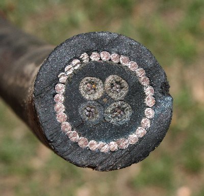
TAIL CABLE: Although no cable has yet being found
at Manza Bay, the type of cable used by the Royal Navy was fairly
standardized by 1943. The following describes
the mining 'tail' cable. The
longitudinal view (below) shows that the cable consists of four cores of 7
strands of 0.029" tinned copper wire laid up with a central square of white
rubber and enclosed in a single layer of india rubber wrapped in a layer of
waterproof tape. This is then covered with 28 galvanised steel armour wires
(each 2.8 mm diameter). Then there is a braiding of two layers of dressed hemp
yarn wound in opposite directions wrapped over hot pitch and resin, and finally
a preservative coating. Final diameter 28 mm. The loop cable is not shown as
none has been recovered from Cromarty. A 4-core able was typical up to 1939 but
then the Adm. Patt. 660 (7-core) cable became standard. Pictures of this cable
and the Patt. 7048 are on my Cablemakers
website.
 |
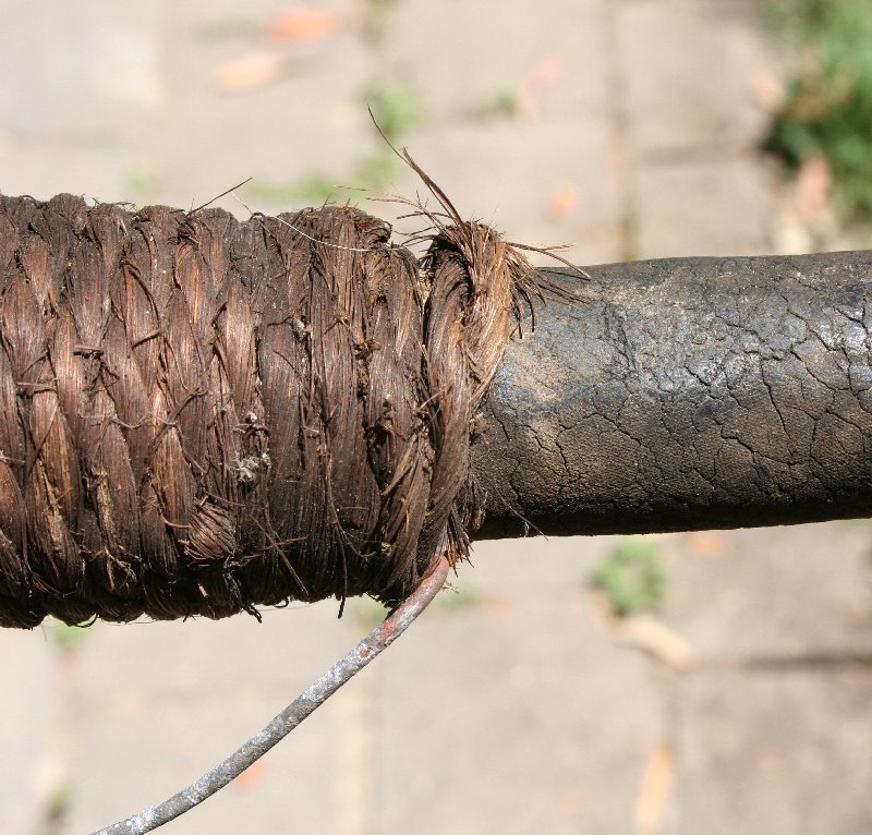 |
| Cross-sectional view of RN Adm Patt 660 Controlled Mining 'Tail' Cable (sample from Moreton Bay, Australia, laid 1943). The outer dressing of hemp yarn has perished. | The jute binding is as good as new after 70 years. The galvanised wire on the bottom is used to secure the cables to the wall. The rubber has surface cracks but is still waterproof. |
LOOP CABLE: Cables used for
controlled mining were Admiralty Pattern 660, Pattern 7048 and Pattern
9610. Details of the cable types can be found on my
Cablemakers website. It is interesting to
compare this XDO Post with that of the Royal Navy's Cromarty (Scotland) Mine Watch Station.
5. THE MINES
The "L" Mark 2 mine units were the most
common being used at that time. They consisted of two 40" diameter mild
steel hemispherical pressings 3/16" thick joined with 1/4" thick bolts. The
charge was 500 lb of amatol with an electric detonator (No. 28, Mark 2)
inserted into a 1 lb charge of primer. The complete mine and charge weighed
3151 lb (1430 kg) and could disable a submarine within a radius of 40 feet.
They had a positive buoyancy of 468 lb meaning they would float. To keep
them moored, a sinker ("L" Mark 2) consisting of a cast iron base with a
drum in the centre housing a cable that could moor mines in water up to 25
fathoms deep.
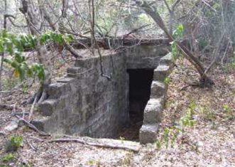
Colour photos of Manza Controlled Mining Station taken February 2009. Photos copyright, Hans-Martin Sommer.
|
|
|
|
The mine control huts |
Underground generator bunker |
 |
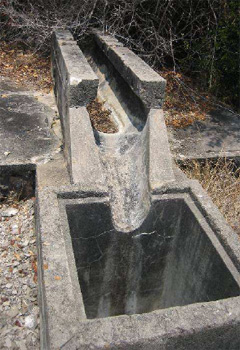 |
| Channels leading from control hut | Channel - possibly for mine loop cable |
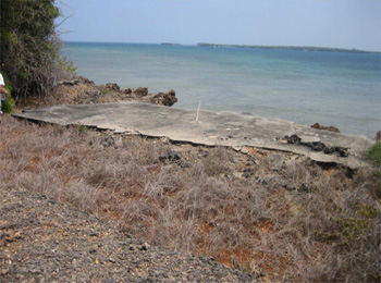 |
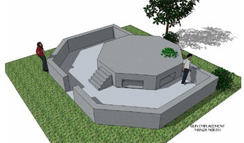 |
|
Concrete slab - north head, Manza Bay |
Gun Emplacement at Manza - North Head |
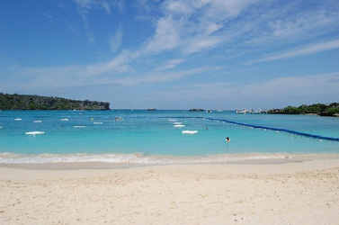
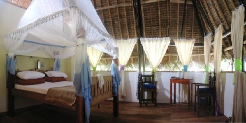
Fish Eagle Point -
ocean resort
We have appreciated the help
of Steve and Cathy Atwell in hosting expeditions to locate, photograph
and map the Manza fortifications. Steve brought these to our attention
in early 2009 and has facilitated the investigation. Steve and Cathy run
the ocean resort on Mkadini Beach at Fish Eagle Point, Tanga, Tanzania,
Africa. This uniquely beautiful ocean resort was opened for business
late 2008. It is just north of the historic City of Tanga and is
Northern Tanzania's first coastal resort. For more information go to
their website Fish Eagle
Point.
 |
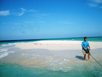 |
| Fish Eagle Point - accommodation | Water sports - Fish Eagle Point |
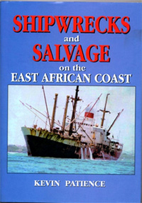 |
For more information about shipwrecks in Tanzania and Kenya
see
Shipwrecks and Salvage on the East African Coast 1499 - 2004 by
Kevin Patience. Click the link to see a flyer in MS Word format. The author
spent over twenty-five years in the diving and salvage business in the
Middle East and East Africa and was involved in some of the operations
described in the book. He dived on and identified many of the other
wrecks mentioned, and is indebted to people from all walks of life, who
kindly opened their diaries and photo albums to find references and
illustrations to some of the more obscure ship’s tales and all are
acknowledged.
|