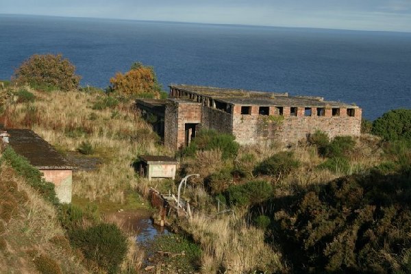
ROYAL NAVY HARBOUR DEFENCES
SOUTH SUTOR IN THE MORAY FIRTH, CROMARTY, SCOTLAND
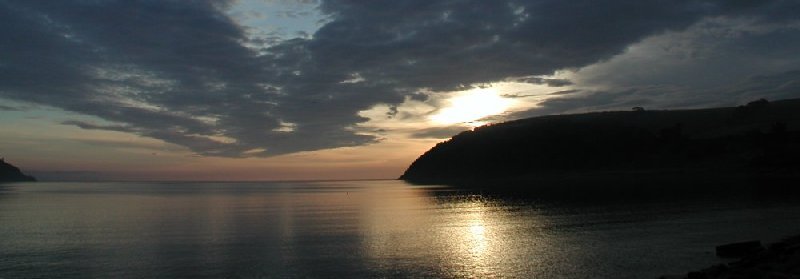
The minefield was in this passage between the North
and South Sutors. Photo by Calum
Davidson, Cromarty.
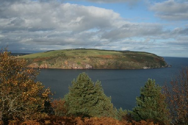
The naval
base at South Sutor was established at the turn of the 20th century and was one
of the more important anchorages until the early 1950s. At the outbreak of World
War II, the Royal Navy installed 'controlled' mines and associated 'guard loops'
at this base for detecting and destroying German U-Boats. This web page
tells a brief story about the decision to install the mines and about the cables
and other equipment needed to effectively defend the harbour in the Cromarty
Firth.
 |
If you worked there or have any feedback please email me: Dr Richard Walding Research Fellow - School of Science Griffith University Brisbane, Australia Email: waldingr49@yahoo.com.au |
LINKS TO MY RELATED PAGES:
Indicator Loops - an overview (YouTube, 70 minutes)
- Indicator Loops around the World (Home Page)
- How an indicator loop works
- Fort Bribie and RAN No. 2 Mine Indicator Loop Station
The Controlled Minefield
On 27th July 1939, the Admiralty finalised its minelaying program for ports at home and abroad for the early stages of the war should it occur. The Admiralty policy was that minefields should only be laid at the outbreak of hostilities and not before as the cost of maintaining the mines and the minefield was prohibitively expensive. Minefields were planned for Hong Kong, Singapore, Alexandria, Malta, Tynemouth and Cromarty Firth. At the RN base at South Sutor, Cromarty, the navy planned four mine loops and two guard loops. Upon outbreak of the war with Germany in September (1939) the minelaying program began in earnest. The mine loops at Cromarty required 30 miles of cable (7 miles of Pattern 660, 20.5 mi of Patt. 7048 and 3 mi of Patt. 9610) and another 13 miles of the four-core Patt. 2865/4 cable was needed for the 'tails'. Personnel were already being trained at the Controlled Mining School at HMS Vernon (Portsmouth, England) and by the Spring of 1940 the CM Base had been constructed at Cromarty (see map and photos below). The Lighter M4 began laying the cables and mines (16 buoyant "L" Mark 2 mines) in early 1941 although the RN had the Cableship Ringdove on standby if needed urgently. The M4 could hold 1400 yd of loop cable and 4000 yd of tail cable. The layout of the minefield is shown below. Please note: the layout is only indicative of the position; however, the number and arrangement of loops is considered accurate. No traces of cables can be found on the steep cliffs of South Sutor or on the beach on the northern side where only the remnants of a few brick buildings are to be seen. However, the search continues.

The galvanometer in use initially was the Mark 2x which had a 45 second period. In mid-1941 a new, more robust and compact, galvanometer was brought to Cromarty for trials in the 15-30 fathom sea channels. It was found to be more than adequate for detecting a 250 ton degaussed submarine in 30 fathoms using a 3-core loop cable. The associated amplifier was the Photovoltaic Amplifier Mark 1 (PVA). The new galvanometer and PVA were used there until war's end. In 1945 - at war's end - the Royal Navy exploded the mines as attempts to recover mines and sinkers was unsuccessful because of lack of power in the mine recovery winches. In other RN controlled minefields throughout the world the mines were also generally detonated and sometimes attempts at recovering the cables were made. In some countries only 50% of the cables were lifted as they were more likely to be covered in mud, sand or coral and after five years in the salty water the condition was usually poor. In the UK, there was greater success and in many cases complete recovery of the loops, sinkers and junction boxes was made. It is not known how much of the mine loops were recovered from Cromarty as individual records seem not to have been kept. The photo below shows the Cromarty mines being detonated in 1945. Source: Cromarty Archive - http://www.thecromartyarchive.org/picture/number1584.asp

The "L" Mark 2 mine units used at Cromarty consisted of
two 40" diameter mild steel hemispherical pressings 3/16" thick joined with
1/4" thick bolts. The charge was 500 lb of amatol with an electric detonator
(No. 28, Mark 2) inserted into a 1 lb charge of primer. The complete mine and
charge weighed 3151 lb (1430 kg) and could disable a submarine within a radius
of 40 feet. They had a positive buoyancy of 468 lb meaning they would float.
To keep them moored, a sinker ("L" Mark 2) consisting of a cast iron base with a
drum in the centre housing a cable that could moor mines in water up to 25
fathoms deep.
Click the following map to see an enlarged view. It
was drawn in 1944. The Royal Navy area is in
yellow:

Base photo from The Royal Commission on the Historical & Ancient Monuments of
Scotland (RCHAMS):

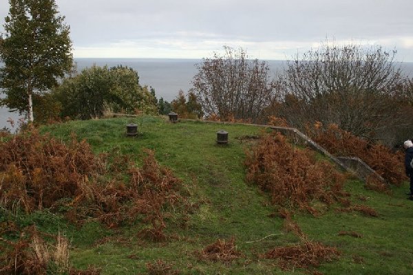
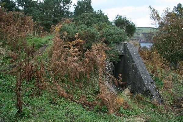
Photos (below) by Martin Briscoe - October 2008
 |
 |
|
|
Ventilation for the Royal Navy Engine Room |
 |
 |
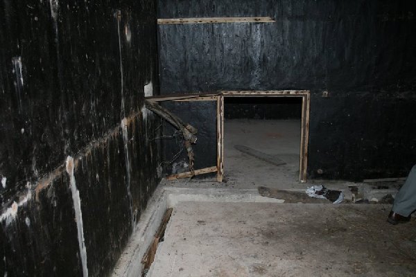
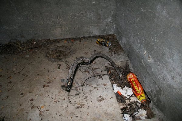
| Cables exit the wall; note the trench in the slab. | The armoured mine and guard loop cables |
 |
|
| Four mine loop and two guard loop cables exit the wall |
 |
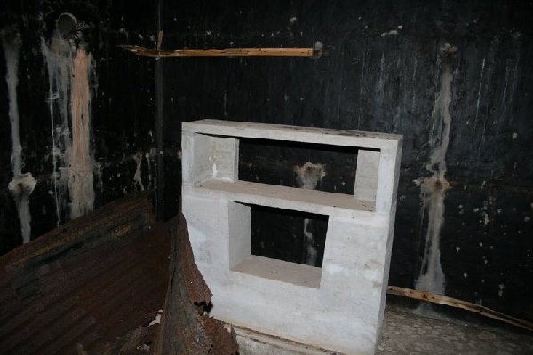 |
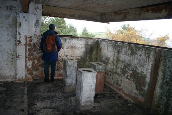
| Entrance to underground Mine Watch Station. The concrete walls are 12 inches thick. | Inside the MWS. Concrete structure - perhaps for the six galvanometers and amplifiers. |
 |
 |
| Inside the Fire Control Post | RN Fire Control (F. C.) Post |
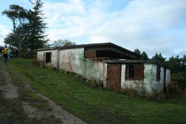
The Extended Defence Officer's (Mine watching) Post
The XDO was the naval officer responsible for all naval activity in a given
area. He had the responsibility for the minefield, boom nets and Port War
Signal Station and was the liaison between the RN and army at Cromarty. His Mine
Control Post was just over 200 yds to the NW of the Mine Watch Station. The
mines were not actually detonated from the XDO's Mine Control Post but messages from the Mine
Watch Station (such as galvanometer swings) were relayed to the XDO who decided
the course of action. If the XDO's visual sightings and communication with the
army revealed the likely presence of an enemy U-Boat, the XDO would give orders
to the officer in the MWS. The orders and firing sequence were the same
throughout all CM stations around the world.
The men in the MWS had to perform daily and weekly tests on the equipment to make sure
it was in good working order and had to record perturbations ("perts" - the
swings of the galvanometer spot due to the tides) every 5 minutes to the
hour. These had to be recorded in the log book. At the end of each watch,
the Handbook of Controlled Mining Confidential Book (CB) had to be mustered
and had to be locked in a CB chest and then placed in a locked cupboard.
The guard loops were 1000 yds to the seaward side of the mine loop so that if a submarine entered the bay it would cross the guard loop first and alert the CM operators. If a swing was detected on the guard loop, the operator in the MWS would close the control switch to start the 300V generator and then ring one long bell to the power hut. The operator would then ring the XDO in the Mine Control Post and report "Mines to Active" and would say the number of the guard loop giving the swing. He would then check to see if the correct voltage was showing on the voltmeter. Then they had to wait.
If a swing was detected on the mine loop after a swing on a guard loop it meant that a submarine had passed over the loops. The operator would then report to the XDO "Mines to Active" again, shift the selector switch to the number of the mine loop involved and fire the mines as the galvanometer spot crossed it's zero after it's first displacement. He would then ring the XDO in the Mine Control Post and say "Mines to Active, mine number XX fired". After 5 seconds, the firing release lever would be released and the selector switch replaced. If there was just a swing on the guard loop they took no chances. The operator would fire anyway. After a firing took place, the fuses in the mine cable would be replaced. Of course, if a boat was sweeping for mines in the area, they should have told the XDO of the fact.
 |
 |
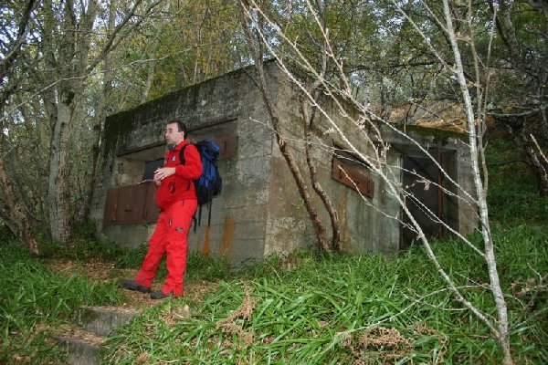
| The Extended Defence Officer's (XDO) post | Observation window on XDO's post |
 |
 |
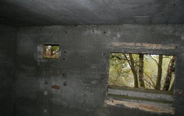
| Inside the XDO's Mine Control post | Power cable inside the XDO's Mine Control Post |
 |
 |
| No. 1 Gun emplacement at South Sutor, Cromarty | Artillery observation post (not naval) |
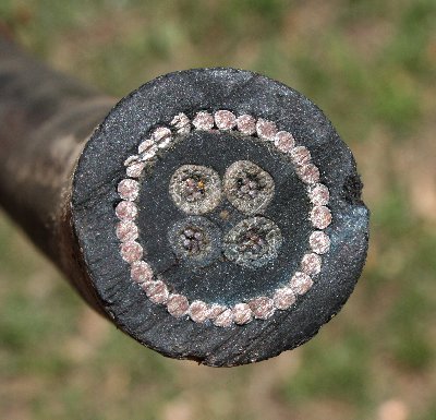
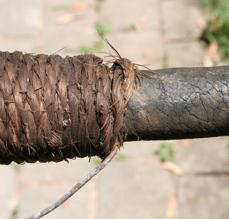
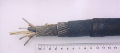
Loop Cable
Details of the mining 'tail' cable. The
longitudinal view (below) shows that the cable consists of four cores of 7
strands of 0.029" tinned copper wire laid up with a central square of white
rubber and enclosed in a single layer of india rubber wrapped in a layer of
waterproof tape. This is then covered with 28 galvanised steel armour wires
(each 2.8 mm diameter). Then there is a braiding of two layers of dressed hemp
yarn wound in opposite directions wrapped over hot pitch and resin, and finally
a preservative coating. Final diameter 28 mm. The loop cable is not shown as
none has been recovered from Cromarty. A 4-core able was typical up to 1939 but
then the Adm. Patt. 660 (7-core) cable became standard. Pictures of this cable
and the Patt. 7048 are on my Cablemakers
website.
 |
 |
| Cross-sectional view of RN Adm Patt 660 Controlled Mining 'Tail' Cable (sample from Moreton Bay, Australia, laid1943). The outer dressing of hemp yarn has perished. | The jute binding is as good as new after 70 years. The galvanised wire on the bottom is used to secure the cables to the wall. The rubber has surface cracks but is still waterproof. |
 |
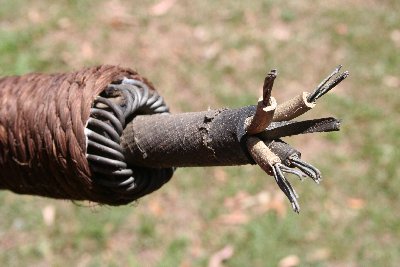 |
| Longitudinal view of RN Controlled Mining 'Tail' Cable. In this sample the outer dressing of hemp yarn is clearly visible. | A "laid-up" end of the cable, complete with jute bindings. |

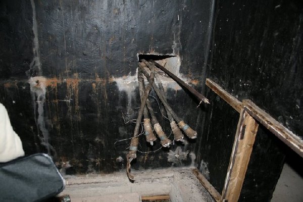
A beautiful photo by Martin Briscoe taken in the pitch black of the mine watch
station at Cromarty. The brass tags may reveal more detail.
Note the similarity with the cable photos from Moreton Bay above.
For an extensive web page on the whole of
Fort South Sutors, Cromarty, see Mike Ross's site:
Fort South Sutor.