
ROYAL NAVY HARBOUR DEFENCES - KILINDINI HARBOUR, MOMBASA
 |
 |
 |
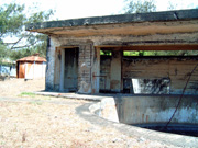 |
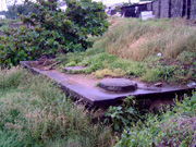
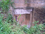
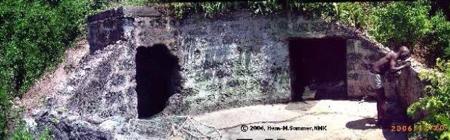
| Generator Room | Kilindini Bunker | Command Post | Gun Emplacement |

|
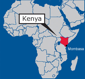
Kilindini Harbour is a
large, natural deep-water inlet extending inland from Mombasa, Kenya. It serves
as the harbour for Mombasa, with a hinterland extending to Uganda and Sudan.
Kilindini Harbour is the main part of the Port of Mombasa, the only
international seaport in Kenya. During World War II, while Kenya was a British
colony, Kilindini became the temporary base of the British Eastern Fleet from
early 1942 until the Japanese naval threat to Colombo, Ceylon (now Sri Lanka)
had been removed. This is a story of the indicator loop defences at Kilindini
Harbour and the Old Port at Mombasa Harbour during World War 2. Further
information can be found on our Mombasa Forts
webpage. |
 |
 |
If you have any feedback please email me: Dr Richard Walding Research Fellow - School of Science Griffith University Brisbane, Australia Email: waldingr49@yahoo.com.au |
 |
My thanks to Hans-Martin Sommer M.A., former Marine
Archaeologist, Fort Jesus Museum, Mombasa, Kenya for his assistance in providing
photos and some text for this webpage. Email: <sudanhansm@yahoo.de>. Hans-Martin has started
a project called: "Defense of Mombasa, 1485- 1945". The range of objects begins
from early Turkish and Portuguese fortifications and ends with many British
bunkers, tunnels and other fortifications and harbour defences.
Hans-Martin has previously worked in Germany, Spain, UK and Poland and
has published widely. He is a member of the British Institute in East Africa
and the Institutum Canarium. He is photographed here in 2006 at a bunker at Kipevu (Port Kilindini)
Mombasa. Click here to see his academic papers online. |
LINKS TO MY RELATED PAGES:
Indicator Loops - an overview (YouTube, 70 minutes)
- Indicator Loops around the World (Home Page)
- How an indicator loop works
- Manza Bay Indicator Loop - Tanga, Tanzania
MOMBASA - PHYSICAL
Mombasa is a small coralline island situated close to the
Kenya Coast and is about 5 km in length north-south by 4 km east-west, covering
an area of about 14.5 km2. The island's relatively sheltered
position, with deep-water anchorages on its eastern and western sides, has
rendered it an important and strategic trading center on the Swahili Coast for
many centuries. The coastline is dominated by low coral cliffs, up to 20 m in
height, serrated by small inlets, bays and promontories. The foreshore is
largely composed of narrow coral platforms and some sandy beaches at the heads
of the creeks. At the northwestern side a shallow ford at low water connected
the island with the mainland in the past; more recently this has been made into
a wide causeway, which together with Nyali Bridge at the southeast, is used
regularly by commuters. These are the only land-based access routes between
Mombasa and the mainland.
MOMBASA - HISTORY
Mombasa's history dates back more than 2,000 years when the Persians, Arabs,
Greeks and Romans visited the East African Coast to trade between the Coast and
the Mediterranean Lands. It is built on what was formerly an Island separated
from the mainland by a narrow channel until a causeway was built at the
beginning of this century connecting the Island with the mainland. Both the
sea-farers from the Persian Gulf, the Indian Sub-continent, the Cape of Good
Hope and the land-lubbers from the African Continent met at Mombasa Island to
enjoy its calm beauty once described by Winston Churchill, (1908) as "alluring
and delicious".
For a period of over 1400 years since the Great Geographer Ptolemy marked the town of Mombasa on his "World Map" of A.D. 150 until the island was seized by the Portuguese who built Fort Jesus there to signify their reign on the East African Coast, Mombasa was the hub of commerce and communications between Eastern Africa, Middle East and the Far Eastern countries. The Portuguese were driven out of Mombasa by the Arabs who ruled the Island until the arrival of the British in 1873. The British established orderly government and development facilities like the Uganda Railway, Kilindini Harbour and several tourist facilities along the Coast.
In the 1940s sailors and visitors arriving by ship would have seen lush vegetation with great baobabs clustered at the edge of the grey coral cliffs together with coconut palms, varieties of giant tropical figs, flame trees and spathodeas with their brilliant red blooms and casuarina pines mingled with broad-leafed indigenous trees. Pawpaw and mango trees grew in backyards and the grass would have been a brilliant green. The red corrugated-iron roofed bungalows of the residential areas would have been mostly hidden behind the foliage. The streets of double-storied shops, offices and small apartment buildings in the commercial centre would showed themselves in shifting glimpses.
|
|
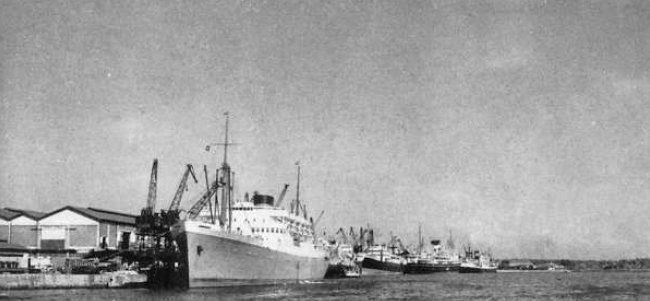
| The deep-water wharf at Kilindini, Mombasa immediately after World War 2 (about 1950). The ship in the middle distance, 17000 tons, was the largest type of vessel then in service in East African ports. |
THE BRITISH EAST AFRICAN TERRITORIES AND THEIR STRATEGICAL IMPLICATIONS
A good summary of the strategic interest Britain had in Kilindini Harbour at the time - and British East African Territories in general - was given in a radio broadcast by Major Sir Humphrey Leggett, D.S.O. on the Overseas Empire Transmission on Wednesday, 19th June, 1940. It was entitled: THE BRITISH EAST AFRICAN TERRITORIES AND THEIR STRATEGICAL IMPLICATIONS and is reproduced hereunder.
THE BRITISH EAST AFRICAN TERRITORIES |
Map of Mombasa Harbour with probable locations of naval defences
The map below shows the probable locations of the
Antisubmarine Indicator Loops and Boom Nets at Mama Ngina Fort defending
Kilindini Harbour. The map also shows the general location of Ras Serani Fort and the
Indicator Loop at Fort Jesus defending the Old Port. The blue line shows the
steamer channel. At the end of this webpage a description of the route and
subsequent stranding of HMS Durban when entering the harbour in 1942.
Most of the defence buildings were made under leadership of the Royal Engineers.
The skilled work was done by Indian artisans (or fundis) and the unskilled by
African labourers, whilst most of the heavy excavation in the hard coral of
which the headland was composed was being done by convicts from the prison in
the Old Portuguese Fort Jesus. Also members of the 'King African Rifles'
assisted the work.
THE FIRST HARBOUR BOOM: It is interesting to note that an anti-boat boom in Kilindini
Harbour was thought of as far back as 1696 when the Arabs (probably from Oman)
sought to retake Mombasa from the Portuguese. Captain Francisco Pereira da Silva
arrived from Goa to support the Portuguese defenders hold up in Fort Jesus while
the Arabs patrolled the harbour. Da Silva claims to have had a nightmare where
the broad Kilindini Channel was blocked by a chain thrown across by the Arabs.
The passage is over 300 m wide even at its narrowest point so quite a large
chain (probably an anchor chain) would be needed. It is not known whether da Silva merely dreamt this or whether he actually saw
it. However, in a 1710 report from the Conselho Ultramarino in Portugal a letter
from a native-born spy in Mombasa said that the chain that the Arabs had brought
with them from Muscat and with which they had meant to block the harbour
entrance, lay unused, because it proved too short, in the Church of Misericordia
(Mackenzie Street, Mombasa). This could be the first recorded use of a boom
chain in East Africa. Reference: Ms. Liss. Conselho Ultramarino, No. 854
Moçambique 10 Aug 1710.

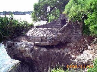
KILINDINI HARBOUR DEFENCES
The main forts defending Kilindini Harbour were The Horseshoe Fort, Ras Serani Fort (Kizingo Camp) and Fort Jesus.
1. HORSESHOE FORT
The Horseshoe Fort is located along Mama Ngina Drive (formerly Azania Drive) and was designed to cover the shipping channel into Kilindini Harbour - the southernmost branch of Mombasa Harbour. On Portuguese maps they called it 'Fortim da ponta restinga'. The army's fixed defences consisted of two 6-pounder guns, an Anti-Aircraft light machine gun emplacement (AALMG), a pillbox, a coastal artillery search light (CASL) and a generator bunker. The Royal Navy fixed harbour defences consisted of an indicator loop and two booms nets. One of the boom nets was found by diver Kevin Patience in 10 metre deep water front of the Yacht Club (about 100 m from the Loop). He was a brave man - the water is infested with sharks. There appears to be a second boom net about another 500 m further on. A number of harbour defence motor launches (HDML) would have serviced the naval defences. The 'Kenya Ferry Service' now owns the site and the ramps. A guard told us of an old retired man who worked from with KFS from before the war when all they had was two rowing boats. During WW2 they acquired two pontoons with an engine to transport military trucks; and in the 1950s they purchased the first ferry. Unfortunately, all of the wartime records of the KFS have been destroyed.
 |
 |
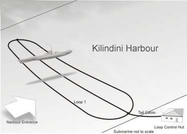
| Loop layout for a harbour with just one indicator loop. For more details see How a Loop Works. | Set-up in a typical Royal Navy Loop Control Hut for two loops. Object 1 is the galvanometer (integrator) and #4 is the chart recorder. |
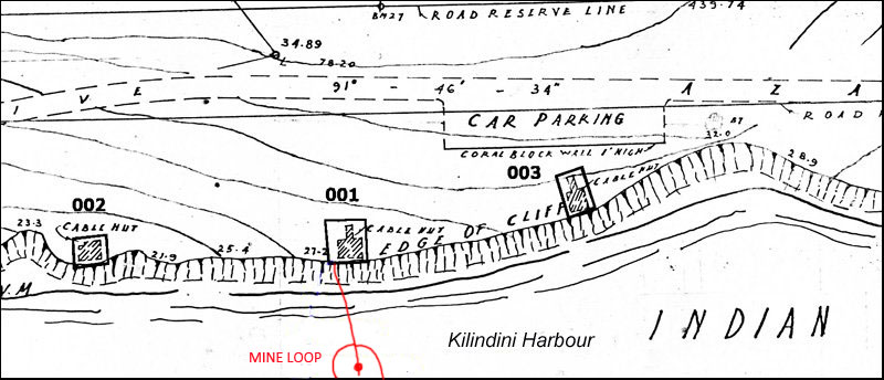
Section of 1945 plan of defences along Mama Ngina Drive.
The following is a section of the Mombasa Defences plan showing the Anti Aircraft Light Machine Gun emplacement probably combined with the Indicator Loop control hut
(001); the Pillbox (002) and the Coastal Artillery Search Light (003). While the
objects 002 and 003 are shown as their real shape on the plan, object 001 is
total different to what it looks like today. It is highly probable that the
former building was destroyed and the foundation or remains overbuilt with the
platform. These defences are an important example of WW2 harbour defences and it
seems important to maintain at least some of these famous defence buildings.
Note: further detail of the fort structures can be found on the
Mombasa Forts webpage.
 |
Map of the structures along Mama Ngina Drive, 1949. The Mine Loops is also seen on the map below. |
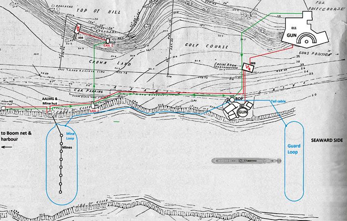 |
A broader map of the structures along Mama Ngina Drive also showing the probable location of the guard loop and mine loop in Kilindini Harbour. (Hans-Martin Somer) |
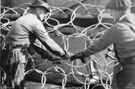 |
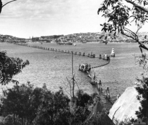 |
| Boom net being constructed in Sydney, Australia. This type of net was used to entangle the Japanese midget submarines that entered Sydney Harbour in May 1942. |
Example of a boom net. This photo shows the Sydney (Australia) boom defences, constructed in 1942. The single line steel anti-submarine net was supported between piles. |
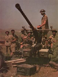
001 - Anti Aircraft Light Machine GUN EMPLACEMENT
The common type of gun was the Bofors L60, developed in the 1930s in Sweden. With the calibre of 40 mm this gun was mounted on a tripod which made this gun very mobile in all directions. British factories later built this gun under licence in variations.
 |
 |
|
Round shaped gun emplacement for an Anti Aircraft Light Machine Gun
(AALMG). Originally, this gun emplacement was made as a solid
concrete platform with a thickness of about 30 cm. Later the outer
wall was added and faced the sea side (see above). The wall was made
from coral rags embedded in concrete. On some parts are remains of
India rubber paint in dark green and grey as part of a camouflage.
The wall to the landside was constructed from coral blocks. A
ammunition embrasure inside the wall contained the ammunition for
the short time use. (Hans-Martin Sommer, December 2006). Copyright. |
The access to the gun emplacement was from the
landside through a tunnel. This tunnel is partly destroyed but can be
entered now from the gun emplacement. One "side arm" of the tunnel
ends because it is closed with coral blocks and concrete. It is unknown
what is behind. From outside, only 6 metres from the emplacement, are
some steps and a "channel" (8cm width, 15cm depth), - the
open part leads down to the water but the upper, horizontal part
is tube-like and leads probably into the tunnel, a room perhaps
(?)
 |
|
|
AALMG Side View. The photo to the left is the gun emplacement for an Anti
Aircraft Light Machine Gun as shown in panorama above.
(Hans-Martin Sommer, December 2006). Copyright. |
Recent damage to the
emplacement. (Hans-Martin Sommer, December 2006). Copyright. |
 The steps as mentioned above. (Hans-Martin Sommer, December 2006). Copyright. |
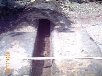 The tunnel/channel as mentioned above. (Hans-Martin Sommer, December 2006). Copyright. |
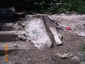
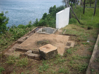
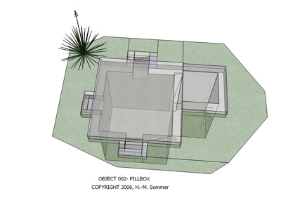
002 - PILLBOX
Pillboxes were also built in strategic places around towns. The name appears from the small space
inside a tablet-box (= pillbox); here a comparison with people in the small room.
Pillboxes above the ground are square buildings, loop-holed with overhanging
reinforced concrete roofs. They exist in various types and were standardized-
the so called "Dover type" were discovered in the Ras Serani area. The
investigations have produced that this one was not only used as a 'air raid
shelter'.
|
|
|
|
Pillbox at Mama Ngina Drive. (Hans-Martin Sommer, December 2006). Copyright. |
After a bit of a clean-up. (Hans-Martin Sommer, December 2006). Copyright. |
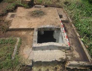
The structure shown above is a small underground 'pillbox' with a base of 2.0 m
x 2.0 m. A entrance shaft (1.0 m x 1.0 m) contains formerly some iron crampons
to climb down- but now stolen by metal scrapers. The internal height is approx.
2.10 m. This building are situated close to object 001 and is marked as 'cable
hut'. The walls inside the room are very smooth without remains of painting.
Several small holes in symmetrical arrangement (wooden plugs) indicating that
some installations were fastened. Below the ceiling are three conical
ventilation embrasures. The entrance shaft was formerly covered with a removable
concrete tile. The pillbox is bordered by a flat trench for diversion of
rainwater.
 |
|
A schematic of the pill box, measured and drawn by Hans-Martin Sommer. Copyright. |
2. RAS SERANI FORT (KIZINGO CAMP)
CABLES
Some of the cables found by Hans-Martin Sommer in the bunkers at Ras Serani Fort
are shown below. It is difficult to identify their exact use. (Hans-Martin Sommer, December 2006). Copyright.
 |
 |
 |
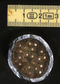
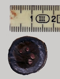
| Cable 1: 21 core. DC or communications | Cable 2: 4 core | Cable 3: Earth or power cable |

Cable 2: cross-section
An Anti-aircraft Gunner's Recollections
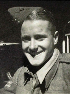 |
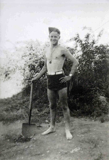
Gunner Ron Myburgh Africa 1940 |
My thanks to Melanie Smith for this extract from her father's memoirs of his time as an AA Gunner at Kizingo Camp at Ras Serani Fort, defending Kilindini Harbour in September 1940. Her father was Ron Myburgh, or Ronald Philip Abercromby Myburgh (1921-2009). He signed up as a 19-year-old 3rd year engineering student at the University of Cape Town when the Italians joined the war in mid-1940, electing to join the next departing contingent rather than have to wait several months until he could join the air force (owing to a shortage of instructors and planes). This happened to be the 4th Battery of the South African 2nd Anti-Airforce Brigade which became known later as the 2nd AA Regiment.
Ron was born in Cape Town. His father's father's line goes back to the original Dutch settlers; the first Myburgh family arrived at the Cape in 1657. But they became English speakers rather than Afrikaans, as many Dutch did. His mother immigrated from England with her parents and siblings and his paternal grandmother's family were from Scotland.
Ron's story starts in the Transvaal, just prior to arriving at Mombasa in 1940.
We were eight men to a bell tent in the cold Transvaal winter for a little over three weeks learning rifle and marching drill and how to cure the 21 "stoppages" of the WW1 Lewis machine guns with which we were going north to East Africa to do battle.
Despite fatigues and army "bull" in general, a great spirit of comradeship started to develop - a spirit, which lasted throughout the war years and to this day. Then by train to Durban and 24 hours embarkation leave before sailing at midnight - with the 5th and 6th Batteries - on the Llangibby Castle, hastily converted into a troop carrier. We arrived in Mombasa on 8 September [1940] after I had endured just one day of violent seasickness in a storm while on storm lookout duty next to the 4th gun. En route we had joined up with a convoy of troops going to Egypt (on the Franconia, Empress of Britain, etc.) but by most nights we had lagged behind, as our ship had trouble with one of its engines. Our Battery was lodged in Tudor Camp on Mombasa Island while the other two went north to a camp outside Nairobi. I developed a high temperature here and was placed in hospital; they thought I had malaria, until a blood test showed that it was merely influenza. When I was discharged I was posted to a sandbagged position on top of the Rex Hotel [Kilindini Road] with a twin Lewis gun. We were spoilt here as we slept in a hotel bedroom and dined in the dining room. However, after a couple of weeks we were moved to a position on the South side of the entrance to Kilindini Harbour where we had to excavate three gun pits in solid coral for our "triangle" of harbour defence guns [about 100m north-east of Horseshoe Fort; Ron would have been stationed at Kizingo Camp at Ras Serani during this time].
We slept in palm-leaf huts and had our own native [African] cook, so life was fairly easy. Eight school Old Boys were in our troop here. We had a small swimming beach nearby and an anti-submarine gun of the E.A. Navy [British Eastern Fleet] from whose crew we were able to borrow a canoe and paddle out over the coral reefs at the harbour entrance. Three items that I recall from this site are the stranding - for 36 hours - of a Swedish oil tanker on the coral; the large cobra that we had to shoot with our rifles in a clump of bush between two of our guns; the flight of an Italian reconnaissance plane over Mombasa at about 20,000 feet - out of range! We learnt afterwards that the Italians thought Mombasa was peppered with heavy A.A. guns because, from the air, the wells that were pumped by having a blindfolded ox walking round and round at the end of a 12 foot pole looked like gun pits in photographs!
One day Alan Melville (the South African cricketer) and I swam via an anchored Japanese ship (Japan remaining neutral at this stage) right across the harbour entrance to a beach where the nurses bathed - a distance of about 500 yards. We returned safely but never repeated swimming a long distance from shore as, about a week later, several of us saw the dorsal fin of a shark swimming down the channel to the sea! In December 1940, we moved up to Kabete Camp outside Nairobi for a brief Christmas stop to prepare for the advance into Southern Abyssinia. We were not to see the sea again for many months and missed our swims and the sights of the convoys arriving with their escorts.
|
.jpg)
After Mombasa, Ron and the 4th A.A. Battery marched into Abyssinia, and then on to Tobruk. It was here that Ron was captured by the Italians, and sent to a POW Camp in Italy and thence Germany. His POW experiences actually determined a change of career path for him, as a result of some of the lectures given in the German camp by fellow prisoners. He decided that he had more of an interest in electrical engineering, which he pursued upon his return to Cape Town. Ron died in Cape Town in 2009.
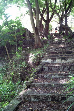
3. FORT JESUS BUNKERS
Note: further detail of the fort structures can be found on the Mombasa Forts webpage.
Fort Jesus was built by the Portuguese fin 1593 by order of King Philip II of Spain (King Philip I of Portugal), then ruler of the joint Portuguese and Spanish Kingdoms. It is located on Mombasa Island to guard the Old Port of Mombasa, Kenya (see map photo above). It was built in the shape of a man (viewed from the air), and was given the name of Jesus, after Shaikh Isa Bin Tarif Al Bin Ali Al Utbi conquered the fort in 1837 after being asked for assistance by Sayyid Saeed Bin Sultan Imam of Muscat. Between 1631 and 1875 the fort was won and lost nine times by the nations contesting control of Mombasa. It was declared a historical monument in 1958. Today it houses a museum. The fort was designed by an Italian architect, Jao Batisto Cairato, who was the Chief Architect for Portuguese possessions in the East. Today, it is one of the finest examples of 16th century Portuguese military architecture, which has been influenced and changed by both the Omani Arabs and the British. The fort quickly became a vital possession for anyone with the intention of controlling Mombasa Island or the surrounding areas of trade. When the British colonised Kenya, they used it as a prison, until 1958, when they converted it into a historical monument.
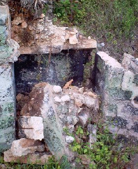
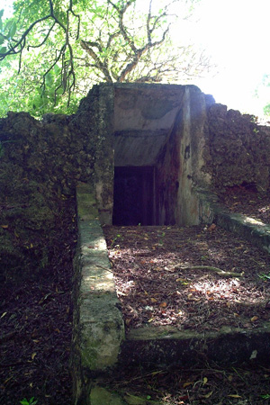
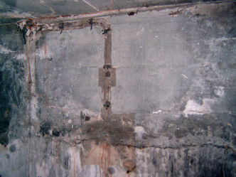
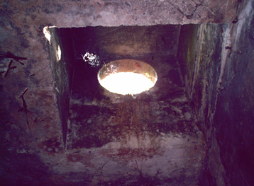
033 - BUNKER (and possible Loop Control Hut)
The bunker with two accesses is located a few metres from the Swahili Cultural Centre. The underground room was dug out from the coral rock which formed a slope down to the ocean. The entrance at the sea-side was through a stair case which was covered by a door (see 033-A below). The wooden door with frame remained. The stair-case leads down into a square room. At the ceiling in diagonal direction three ventilation openings are integrated. Above the earth-level they are covered with 'huts'. The room was extended by three embrasures- two bigger ones at the floor level and two smaller but larger ones dug out from the walls. The walls showing traces of former electrical (Photo 033-C). Entrance to the bunker installations for cables, boxes etc. The other entrance/ exit had also a door but apart from the fastenings nothing has survived to date. The function of the object is not clear. It is quite probable that the room was used for the installation of the second loop-station (see object 001 above for description of Loop station #1). The ventilation-huts on the top indicate the necessity for air-circulation (Photo 033-D).
 |
 |
| Photo 033-A. Eastern entrance. (Hans-Martin Sommer, December 2006). Copyright. |
Photo 033-B. Steps to the northern entrance. (Hans-Martin Sommer, December 2006). Copyright. |
 |
 |
| Photo 033-C. Wall inside bunker showing location of cables and
electrical instruments. (Hans-Martin Sommer, December 2006). Copyright. |
Photo 033-D. Ceiling vent in Fort Jesus bunker. (Hans-Martin Sommer, December 2006). Copyright. |
Unfortunately the research for this object could not be finished. The room is recently being used as a store for several hundred kilograms of useless pottery sherds from excavations of the 1960. Archaeologist Hans-Martin Sommer recommended that the room should be emptied so that more exact measurements could be taken, with the prospect of determining the exact nature of this bunker. It is a military object showing the more recent history of Mombasa and is in a good state and close to Fort Jesus (as the old military counterpart). With little more maintenance of the bunker can become a small but interesting object for visitors.
CONCLUSION
A significant proportion of the island has been altered to a large extent by development throughout the twentieth century, but in spite of this, areas of high archaeological potential do still exist. Although some conservation initiatives have produced results, there are various difficulties to overcome, such as increased population pressure and inadequate legislation. There is an increasing urgency to glean as much information as possible from these rapidly vanishing resources. It is hoped that more detailed survey, combined with excavation and further research, will be undertaken in the future, particularly with regard to Mombasa's early development, and it's WW2 history.
ROYAL ENGINEERS
The following is a description of the construction of fortification by the Royal Engineers by the officer in charge. The Indicator Loop cables were installed, connected and operated by the Royal Navy. The loop control hut and associated buildings (accommodation, power huts) would have been constructed by local labour. Reproduced in The Royal Engineers Journal, Vol 108, No. 2, August 1994, pp 201-208. The Navy had heavy demands for buildings for shore, headquarters, signal stations, temporary accommodation for ratings, and ammunition and stores of all kinds. Much of this was met by requisitioning public buildings such as schools, hotels and warehouses, but a great deal of modification was needed to meet full requirements. On the mainland to the north a leave camp was established for the thousands of sailors off the ships, to the south an armament depot in the bush adjoining Port Reitz was being constructed. The air forces (RAP, Royal Naval Air' Service, and South African Air Force) were not active on the island itself, but were developing a big new airfield on the mainland west of Port Reitz - which is today Mombasa international airport - where the South African Engineer Corps were, using such giant machines as we in East Africa had never seen before.
I assumed responsibility for priority defence projects which included the following major works already started: • replacement of the old two-gun 6in battery at Ras Serani - which I had installed in 1936/7 - by three modern 6in guns in power-operated turrets capable of 45 degree elevation, and much greater range; • harbour defences of smaller guns, and searchlights covering both Kilindini Harbour and Mombasa Old Port, and linked to underwater detection loops installed and operated by the Royal Navy; • the construction of an underground combined operations room and battle headquarters at the west end of the island; • engineer assistance to the two infantry battalions, aad other troops garrisoning the island, in the construction of trenches, pillboxes, covered machine-gun posts and other field defences covering the most likely lines of enemy attack; • accommodation works of all sorts, by modifications to existing buildings, temporary construction, and the provision of ancillaries for camps; • development of emergency water supplies and storage facilities,aa Danae-class light cruiser of the Royal Navy Danae-class light cruiser of the Royal Navy against the possibility of the water pipe from the mainland being cut by enemy action;
• engineer assistance to the mobile brigade at Mariakani, by the provision of camp structures, the development of water supplies by boring, and the improvement of roads and tracks from Mariakani to points on the coast north and south of Mombasa for rapid movement to counter enemy invasion. I also took over responsibility from the second CRE for engineer works. along the East African coast from the border with ex-Italian Somaliland in the north to the Mozambique border in the south; in a previous appointment I had reconnoitered this coast extensively and reported on the most likely beaches for an enemy landing. I also became responsible for the installation of coast batteries at Tanga, Dar-es-Salaam and Zanzibar; for other minor works along the Tanganyika coast and on Zanzibar..' Island, and for the chain of coast-watchers up and down the Kenya coast. My staff included few regular Sappers. Those who were in East Africa were mostly in the field units of the EA Engineers, a new Corps similar in composition to the King's African Rifles (KAR), with British officers, some British NCOs, and African other ranks, which had formed just before the outbreak: of war, and which was expanding to provide engineer units for the EA Division then forming and preparing to move to Burma, I was fortunate in the temporary officers, warrant officers and NCOs of my staff, some of whom were East Africans with local knowledge and experience of the natives, and others from the UK; all of them were qualified in one aspect of engineering or another, and I tried to make the best use of their qualifications. Unfortunately when I arrived my DCRE was under open arrest for allegedly "forcing a sentry" during the blackout. Fortunately I was able to get an able lawyer, then Major Soskice ALS (Army Legal Services) to defend him, and he was acquitted. My first adjutant was highly qualified in the design of reinforced structures, so I transferred him to planning the roof of the underground operations room, and other concrete works, and got in his place a regular, officer, Captain R A Bevan who had been injured in an accident and was temporarily medically downgraded. My dozen garrison engineers were disposed in charge of various major projects, or groups of similar projects; when a new major project arose they were redistributed to free one to tackle it. For example, soon after I had assumed my appointment, an entire British AA brigade arrived from England without any advance warning. They set about deploying their guns and searchlights on sites on the island and the mainland, mainly to give protection to the fleet in Kilindini and to the new airfield, as well as to the island. Their need for engineer assistance of all kinds to gain access to the often remote hilltop sites they naturally tended to choose, to provide water supplies, and other camp ancillaries, added a considerable extra load to our stretched resources, and required a garrison engineer to oversee the tasks. The main considerations dominating all these disparate and scattered works was the urgent need for speed, and the dire shortage of resources. |
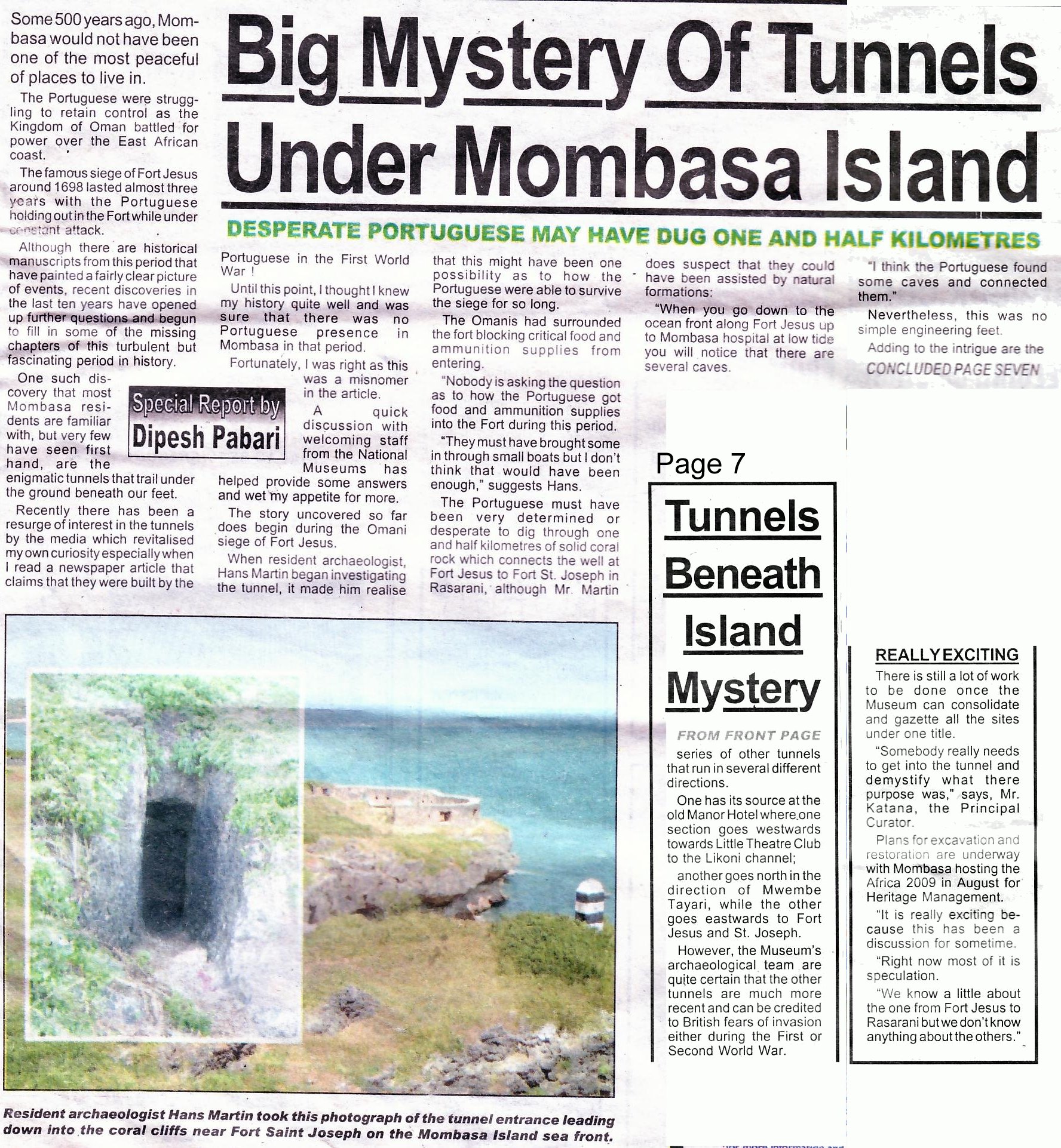
Newspaper article on Hans-Martin Sommer's research.
Source: 'Coastweek' newspaper, Mombasa, 1 June 2007. Also published
at the same time in 'Old Africa' , a 2-monthly journal made by a
Norwegian about Kenya & Tanganyika history. Nice!
Please click image to see full size version.
Grounding of the HMS Durban. Information provided by Kevin Patience.
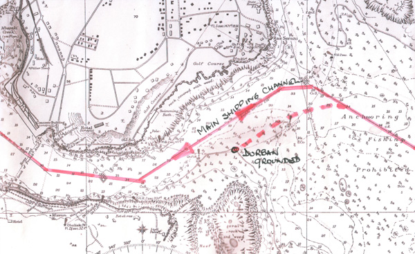 |
| This map shows the correct shipping route as per the pilot notes as well as Durban's approximate route when she grounded in December 1942. Courtesy of Kevin Patience and Henry Gunston. |
|
|
|
HMS Durban - 4650 tons - light cruiser of the Royal Navy |
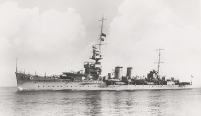
In 1942 Kilindini Port contained three battleships H.M.S. Resolution,
Revenge and Warspite. Many warships stopped at Mombasa for refuelling
and one of these was H.M.S. Durban on passage from South Africa. On the
afternoon of 8 December 1942 the cruiser approached the channel leading towards
the lighthouse at Ras Serani. A signal alerted the
boom vessels and the nets were opened. For reasons unknown the ship turned to
port (see dashed line on map above) and when the error was noticed a hurried starboard correction was made. But
it was too late and the ship grounded on the northern end of Andromache Reef. A court martial was held a week later on board
H.M.S. Warspite. At the end of a gruelling session in which a number of
officers and the captain were cross examined, the court retired and later
returned their verdict. The captain was severely reprimanded and rejoined the
ship and the navigating officer was posted to another ship two days later. The
cruiser sailed shortly after for Bombay and drydocked on 5 January 1943 for two
months repair work. On completion the ship returned to Mombasa and this time
collected a pilot before entering harbour. In 1944 Durban was stripped of
her fittings and sunk on the 9 June as part of Gooseberry 5 sea defences at
Ouisterham, Normandy. After the war she was salvaged and scrapped.
Note: The author Kevin Patience, despite having researched and written
about the wrecks and dived extensively in Kilindini Harbour, said that he was
unable to locate the remains of any indicator loops. However, he did locate the
remains of one of the anti-submarine boom nets (the one closest to Loop 1).
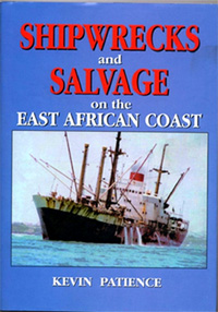 |
The extract above comes from
Shipwrecks and Salvage on the East African Coast 1499 - 2004 by
Kevin Patience. Click the link to see a flyer in MS Word format. Using records in Australia, Germany, Kenya, Tanzania, Zanzibar and the U.K. as well as the library's of Lloyds Register of Shipping, the Guildhall and the National Archives in London together with the Hydrographic Office records at Taunton, the author has discovered the stories of over 200 merchant and naval ships that came to grief. The publication covers most of the known casualties that were wrecked or salvaged along the coast from the Kenya / Somali border to the Tanzania / Mozambique border, a distance of 1,400 miles. The inland lakes including Tanganyika and Victoria also had their fair share of casualties and these are included, as are all the tugs from 1896 to date since many played a part in the salvage operations. The author spent over twenty-five years in the diving and salvage business in the Middle East and East Africa and was involved in some of the operations described in the book. He dived on and identified many of the other wrecks mentioned, and is indebted to people from all walks of life, who kindly opened their diaries and photo albums to find references and illustrations to some of the more obscure ship's tales and all are acknowledged. 276 pages, H/Back, over 300 illustrations and three maps and weighs 800 gms. £15 posted to UK and £25 to other destinations by airmail. Available from the author - 257 Sandbanks Road, Poole, BH14 8EY saburi@hotmail.com
|