ROYAL NAVY
ANTI-SUBMARINE HARBOUR DEFENCES - OBAN
Oban is a small town on the western coast of Scotland near the island of Mull about 95 miles North of Glasgow. During WW2, merchant ships gathered there under the protection of the Royal Navy and joined up with larger convoys to the USA, Russia and elsewhere. A few miles to the north is Ganavan, a headland which offers an excellent view of the waters around Oban. It was on Ganavan headland that the Royal Navy established the "Little Ganavan" anti-submarine Indicator Loop Station. This is its story.
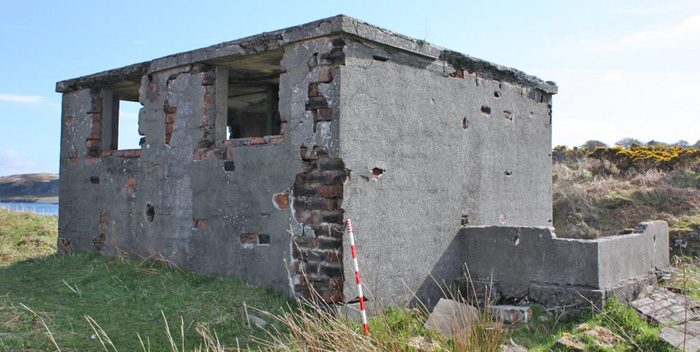 |
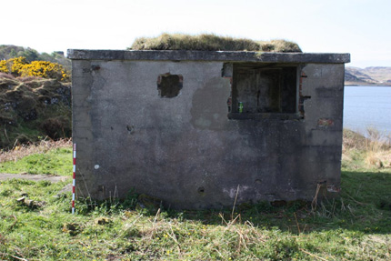
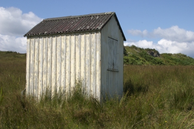
The Oban Loop Control Hut. It was made of brick but rendered with concrete for camouflage. (Martin Briscoe, 2009) |
 |
If you have any feedback please email me: Dr Richard Walding Research Fellow - School of Science Griffith University Brisbane, Australia Email: waldingr49@yahoo.com.au |
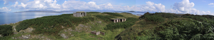 |
Oban Loop and Generator Huts at Ganavan, Scotland. The Isle of Mull is in the background. (Martin Briscoe, 7 May 2000) |
LINKS TO MY RELATED PAGES:
Indicator Loops - an overview (YouTube, 70 minutes)
Anti-submarine 'indicator loops' are long lengths of cable laid on the seabed in shipping channels of strategically important ports. They rely on the production of an induced current in a stationery loop of wire when a magnet (in this case, a submarine or surface ship) moves overhead. Even if wiped or degaussed, ships (including submarines) still have sufficient magnetism to produce a small current in a loop. The current is detected by galvanometers at a Loop Control Station on the shore. This technology was developed by the British Royal Navy at HMS Osprey (Portland Naval Base) and HMS Vernon starting back in 1915 and first deployed at Scapa Flow, in the Orkney Islands at the northern tip of Scotland. In 1996, a portion of the Oban Bay loop cable was brought to the surface by a clam dredger about 500 m offshore from the island of Lismore just to the north of Lismore lighthouse. It was actually marked as a navigation hazard for a time. Encrustation meant that the cable is now a pretty inflexible and bulky object.
WHERE IS OBAN
 |
Location map of Oban. Glasgow was 95 miles to the south-east. It was a favourite place of Queen Victoria no less. |
THE ANTISUBMARINE LOOP DEFENCES AT OBAN
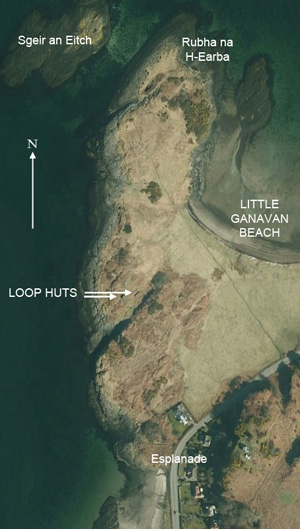
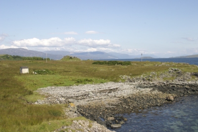
The map below shows the disused harbour defence control huts used by the Royal Navy for its antisubmarine indicator loop defences in World War 2. They are located at Ganavan headland near Oban Bay - Argyll, Scotland - 95 miles north-west of Glasgow. The land is currently owned by Dunollie Estates and tenanted by farmer Alaistair MacLeod - a special constable at Oban.
 |
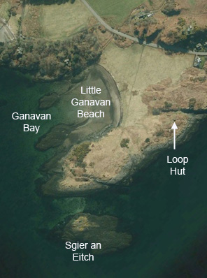 |
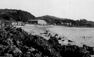
Photo of Ganavan headland taken in 1945.
During the war the area was surrounded by a barbed-wire fence and the huts
were hidden in the bush and not visible from the road or the signal station.
|
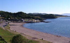
Google Earth image of Ganavan headland taken in 2010 orientated to match photo on left. Today, the area is more open and grassy and the remains are quite visible from the road. |
 |
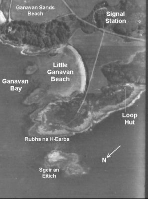
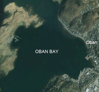
Google Earth image of Oban and Little Ganavan Bay (2010). To get to the Loop Hut, start in the middle of Oban town on the Esplanade (the War and Peace Museum for instance) and continue North straight along Gavanan Rd 2.2 km until the last house. On the headland to the north-west are the loop huts. It looks flat from the air but is quite hilly. Go a bit further and there is easy parking at Little Ganavan Beach. Continue along to Ganavan Sands Beach (where the floatplanes landed). |
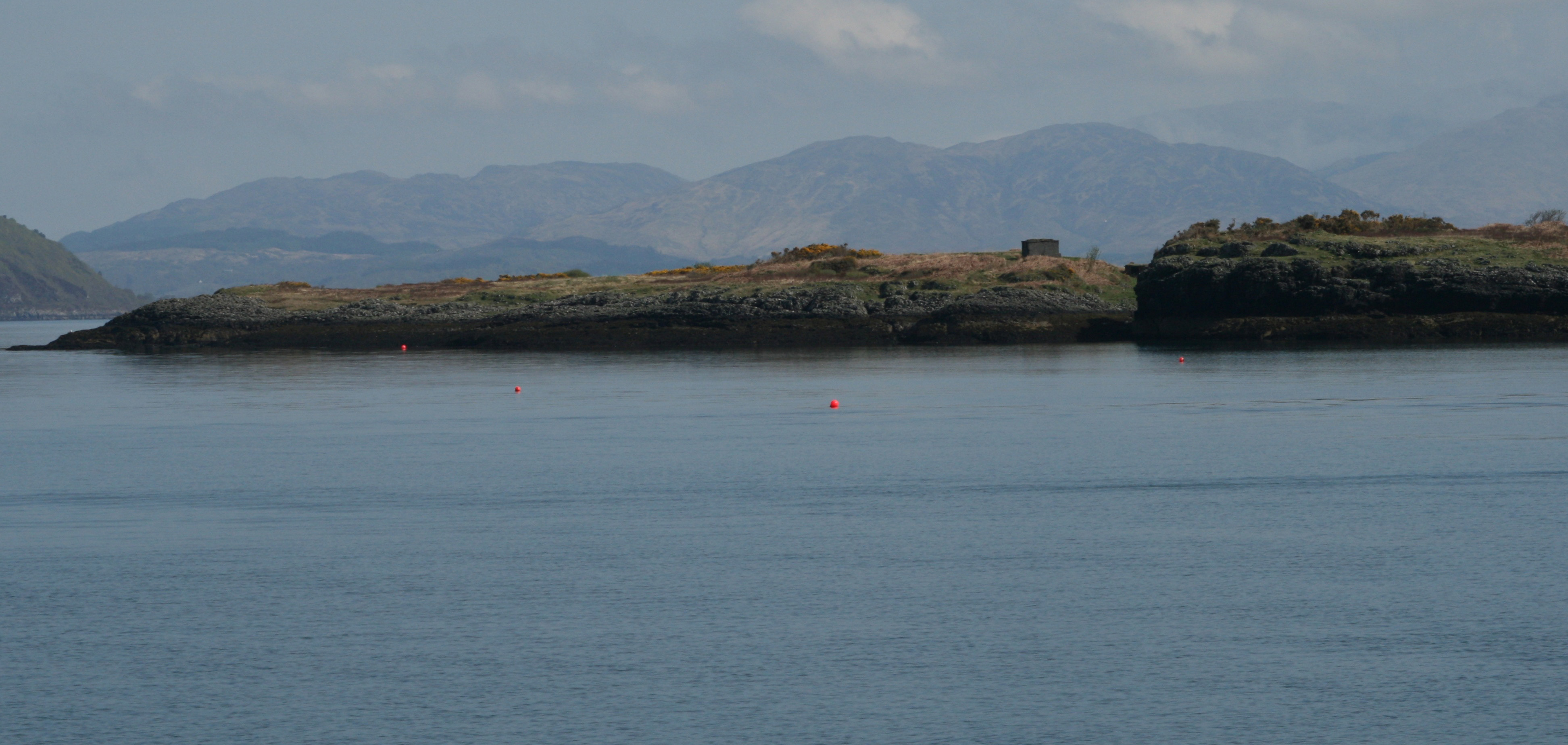 |
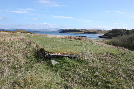
The Ganavan Headland in 2008. The Indicator Loop Control Hut is the dark grey building just to the right of the middle. The loop cables came down the crevasse to the right of it and headed almost directly towards you. In the backgound are the mountains of South of Ballachulish and also some of Glencoe. Click the image to see an enlarged view. (Martin Briscoe, 2008) |
A BRIEF HISTORY
In the 1930s, Admiralty policy was that important harbours should be progressively defended by fixed anti-submarine defences consisting of one or more indicator loops. Loops took a fair while to survey, plan and lay and this lead time was thought necessary. If hostilities arose, the plan was that the Royal Navy would then lay harbour defence Asdics (HDAs) and controlled mines. However, it became apparent that the cost of repairing and maintaining existing loops was becoming prohibitive so the laying of more loops had to wait until conflict occurred. By 1938, the possibility of conflict with Germany was most likely so loop laying was stepped up. By 24th August 1938, four ports were protected (Portsmouth, Portland, Plymouth and Firth of Forth) with the Straits of Dover being added in Autumn 1939. Two others - at Penang and Singapore - were also under RN control. Others, such as Falmouth, Berehaven, Queenstown, St George's Channel, North Channel and Tynemouth were planned for 1940-41 as well as overseas loops at Singapore, Alexandria and Malta. No loop station was planned for Oban Bay.
In early 1940, with the imminent fall of France and the threat of invasion, many emergency coast batteries and harbour defence stations were constructed. On the 6th February 1940, the Admiralty decided that Oban Bay should be used as an additional naval base to the Kyle of Lochalsh, which was the gathering point for convoy ships but could not provide the facilities that Oban could. The role of the navy was to protect and administer the harbour and surrounding waters, to accommodate merchant ships in the anchorage and organise the sailing of the convoys to join with larger convoys to the USA, Russia and elsewhere. The naval detachment at Oban grew as France fell and more and more convoys were rerouted from the English Channel and South Ireland to the waters between Northern Island and Scotland. The loss of the Irish ports was greatly felt. So the loops were finally laid at Oban.
 |
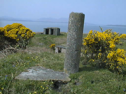
A closer view of the Loop Station. The Loop Control Hut is clearly visible on top of the rise with the Generator Hut tucked away out of view (in the middle). The loop tail cable would have come down the crevasse and out towards the red buoy. The mountains in the backgound are of South Ballachulish and Glencoe. (Martin Briscoe, 2008) |
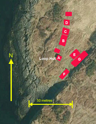
LOOP CABLE LOCATIONS
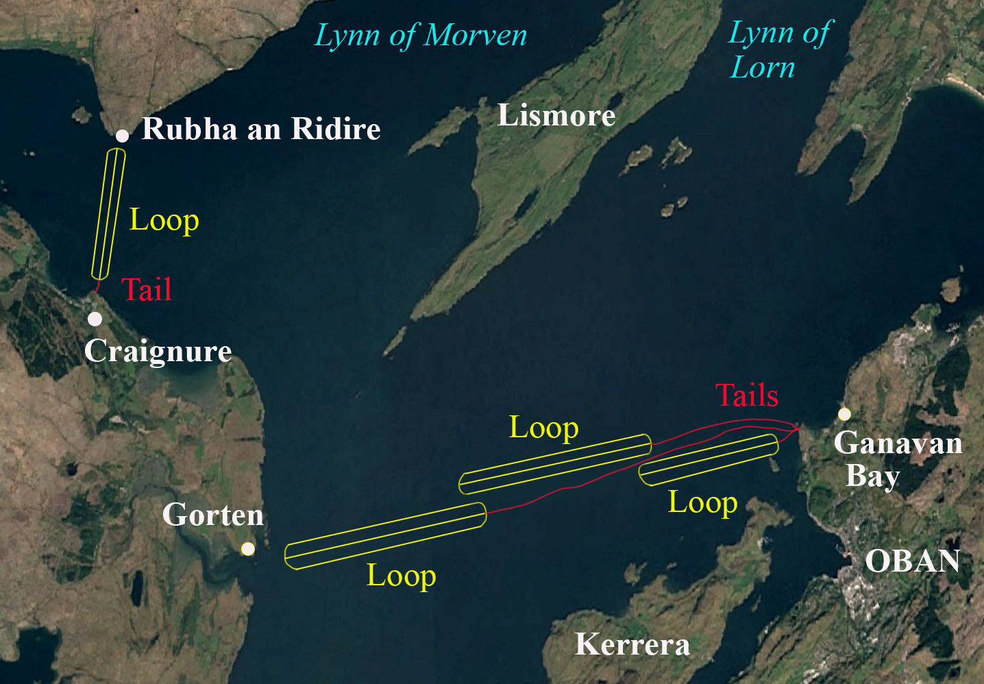 |
There were two sets of loops at Oban Bay. It would seem that Ganavan-Gorten loops went from Ganavan headland (just a little bit north of Maiden Island) across to the beach to Gorten just north of Loch Dun on the Island of Mull. The Craignure loop stretched from Craignure (on Mull) across the Sound of Mull to the tip of the Morven district (Rubha an Ridire). I am not sure how many loops made up each set but typically loops were about 2000 yards long and 400 yards wide. So I've estimated three loops at Ganavan and one at Craignure. The Ganavan tails came ashore where I have indicated. The Craignure tail most likely came ashore at Craignure as I don't think the Admiralty would have had a 12000 yard tail to Ganavan. There was probably a loop hut at Craignure. |
The USN set up
about a dozen 'loop receiving stations'
on the East Coast, Panama and San Francisco. The Royal Australian
Navy installed indicator loops at a dozen sites around Australia and Port
Moresby from 1939 to 1942. Loops were also installed by the RNZN at Auckland Harbour
in 1942, and by the RCN at Saint John, Digby and Prince Rupert (Canada) from
1942 onwards.
GERMAN RECONNAISSANCE PHOTO
 |
 |
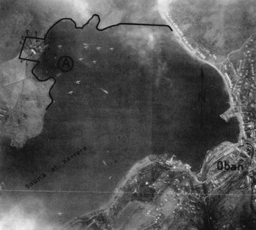
This Luftwaffe reconnaissance photo of Kerrera Sound was taken in December
1940. It shows the naval base at Oban and aircraft of 210 Squadron RAF at their
moorings. |
Google Earth image December 2010. The Loop Hut is about 1.3 km north of the top of the image. The loop cable came down near the top of Kererra Island (to the left) and monitored access into Oban Bay from the north. |
THE BUILDINGS TODAY
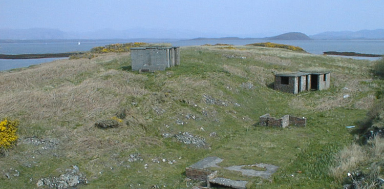 |
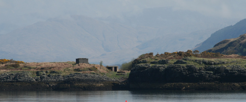
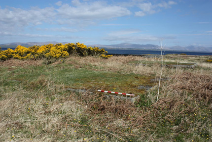
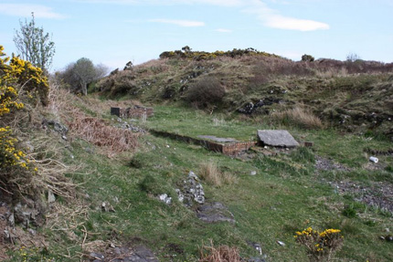
| A full view of the headland overlooking Oban Bay. Building
"A" - the Loop Control Hut - is in the centre on top of the hill, and building
"E" - The Generator Hut - is in the gully to the right. The remains of building "F" are in the
foreground. The Isle of Mull is in the background to the left and Lismore
Island is to the right. (Martin Briscoe, May 2000) |
 |
 |
|
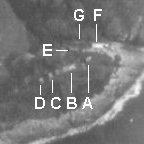
The diagram above left shows the relative location of the concrete huts and
slabs. Only buildings A (The Loop Hut) and E (The Generator Hut) remain standing today. The photo on the
right shows the huts as they were in 1945. |
|
THE LOOP CONTROL HUT
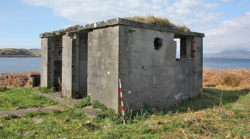 |
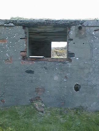
The Loop Control Hut ("A") viewed from the north west.The room closest to you is the "Loop Room" where trained sailors (watchkeepers) would "watch" the instruments for signs of a submarine. The room closest to the water was the Binocular Room where an officer would scan Eastwards over the underwater loop with binoculars. (Martin Briscoe, 2009) |
The operation of a Loop Station was fairly straightforward. Once the signalmen at the Port War Signal Station (see later) identified a ship entering or leaving the area (by Aldis lamp or signal flags) they would relay this information to the Loop Control Hut by telephone and this would be noted in the Loop Station's log book by the Officer in Charge. The watchkeepers in the Binocular Room of the Loop Control Hut would constantly monitor the waters over the loop for ships and also monitor the recorder chart on the wall in the Loop Room. Once a message had been received from the PWSS they would keep an eye out for the ship. The watchkeeper on the loop recorder (either a paper roll or on a screen) would wait for the characteristic "signature" of the ship and call out "crossing on one" to indicate the crossing of loop "1" (or Loop 2 as the case may be). Such a watchkeeper was well trained for this work - usually at HMS Osprey at Portland or later Dunoon. They would be designated "Submarine Detector" (SD) after a short course, or "Higher Submarine Detector" (HSD) after the long course.
The officer would scan the loop area with his binoculars and if a ship was visible he would call out "ship" to confirm the crossing, and note this in the log book and match it with the ship's name. If a signature appeared on the recorder chart ("crossing on one") but when the officer looked and nothing was visible through his binoculars, the officer would say "non ship" to indicate that nothing was there. This would strongly suggest that a submerged submarine had crossed the loop and hence would be an enemy submarine (for friendly submarines always entered a harbour on the surface). The officer would then relay this ("sub on Loop 1") to the PWSS who would decide what to do. For a definite loop crossing but where "no ship" was visible, a harbour patrol vessel (armed with machine guns and depth charges) would be sent ot investigate.
 |
 |
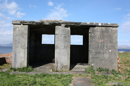
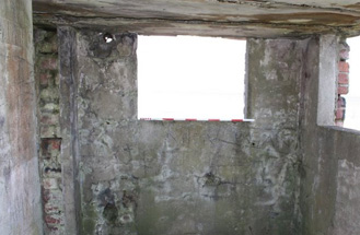
The Binocular Room (left) and the Loop Room (right) had windows to the East overlooking the bay so watchkeepers could make visual sightings. (Martin Briscoe, 2009) |
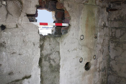
A Northern side window in the Loop Room would enable watchkeepers to look towards the island of Lismore. The 30cm diameter hole in the wall was originally the size of a brick but has been smashed out sometime between 2000 and 2009. It was for a ventilation duct. (Martin Briscoe, 2009) |
 |
 |
| The rear wall of the Indicator Loop Room of the Loop
Control Hut as it is today. The rear and right-side windows are now open to the
elements. A doorway leading to the left room (Binocular Room) can be made out. (Martin Briscoe, 2009) |
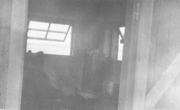
This photo of a naval rating in the Indicator Loop room of the Control Hut
was taken during WW2. It is the same room as shown to the left. The rear and
side observation windows and frames are clearly discernable although the
equipment being monitored by the rating is not clear. The wooden door, door
jamb and cement-rendered brick is visible. |
 |
 |
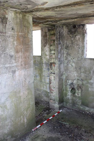
Doorway from the Loop Room to the Binocular Room. The measuring rod is one metre long. Blackout curtains would have hung mid-ceiling so that no light would be seen from the front. Not ethe big hole in the front wall just above the measuring stick. It is likely (given the size and position) that this was where the tail cables came in. (Martin Briscoe, 2009) |
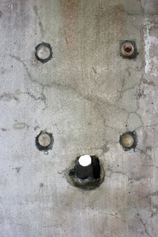
The mounting plugs on the Northern wall in the Loop Room with the (power) cable entry underneath. The plugs are about 25 cm apart and would possibly have held the Balancing Box. This device is used to balance the resistance between the two halves of the loop. (Martin Briscoe, 2009) |
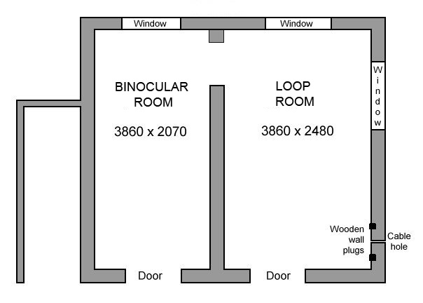 |
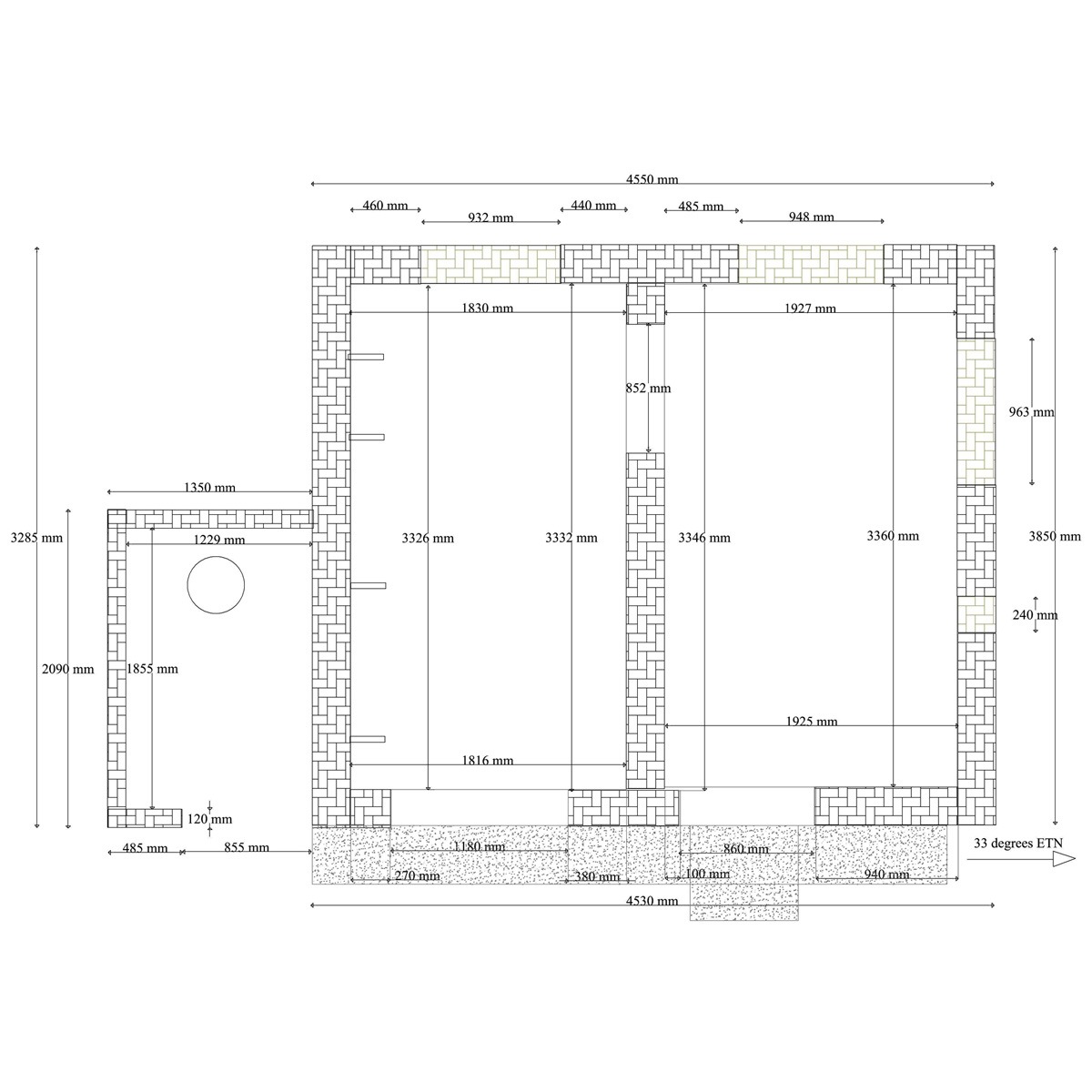
| The floorplan of the Loop Control Hut (Building "A"). Walls are
double thickness brick (230 mm wide) and the windows are 1200 mm wide and 900
mm deep. On the right there is a small hole in the wall through which cable
(probably power) runs. Above it are four pieces of dowel embedded in the wall to which some
equipment was affixed. |
 |
 |
The ventilation opening in the northern wall - with views to Lismore. It was once about 4" x 3" but has been smashed out. The wall plugs for the loop instruments are visible as is the hole for the power cable (probably). (Martin Briscoe, 2009) |
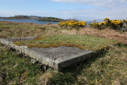
Another slab north of the Loop Control Hut may have been the foundations for the workshop or store room. I am not certain. (Martin Briscoe, 2009) |
 |
 |
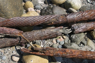
The low hole out of the front of the Loop Control Hut is most likely the entrance for the two tail cables (each 25 mm in diameter). For more information about the cables go to my Cablemakers webpage. The loop cable would have been Adm Patt. 1989, and the tail cable would have been Adm. Patt. 7048. (Martin Briscoe, 2009) |
Several things to note here. In thius 2000 photo the opening for the ventilation duct is quite small ((3" x 4") whereas it is much bigger in 2009 - suggesting vandalism. The small hole in the middle was most likely for a power cable. Another small hole to the bottom left has a cable in it but it seems more modern and looks like a communications cable. It is not a loop cable. (Martin Briscoe, 2009) |
 |
 |
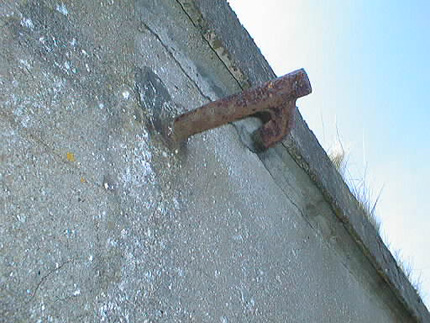
The hook on the outside wall may have been used to hoist the power cables up and keep them in position. It is not sure. The other end is a sharpened spike which extends into the Loop Room about 20 cm. Why this is no-one knows. (Martin Briscoe, 2009) |
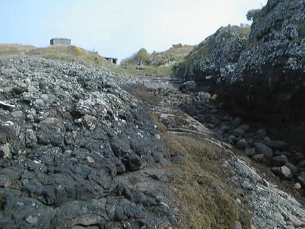
The crevasse leading from the Loop Control Hut to the water would have been the path for the tail cables. They were heavily armoured with steel wire to prevent from being damaged on the rocks. (Martin Briscoe, 2009) |
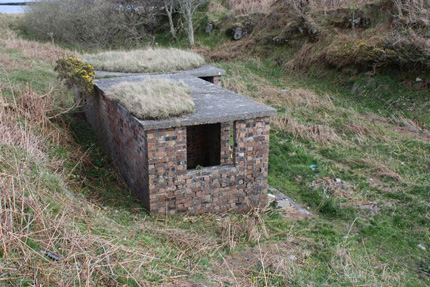
THE GENERATOR HUT
 |
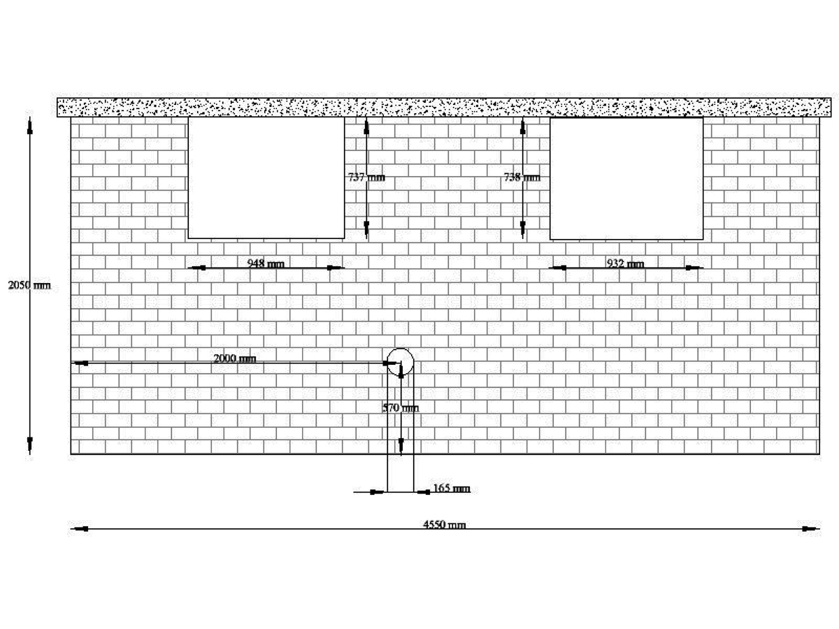
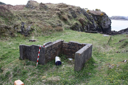
Building "E", viewed from the South East.Three rooms: two are 2270 mm x 2070 mm, and the third
is 3670 mm x 3670 mm. (Martin Briscoe, 2009) |
 |
| Building "E" - The Generator Hut - floorplan. The walls are double layer bricks about 230 mm thick. It is difficult to know what each room was used for but I suspect that the left room was the fuel store, the middle room housed the motors and generators, and the rightmost room seems like it was the workshop. |
 |
 |
The Generator Hut viewed from the top of the steps from the Loop Control Hut. (Martin Briscoe, 2009) |
Doorways to the Generator Hut. The middle room has a vent opening at the rear. This could have been for the exhaust fumes. (Martin Briscoe, 2009) |
DRAWINGS
 |
 |
Plan of the Loop Hut (Martin Briscoe). Click image to enlarge. |
Rear elevation of the Generator Hut (Martin Briscoe). Click to enlarge. |
 |
 |
A small slab north of the Loop Control Hut. (Martin Briscoe, 2009) |
Some more slabs heading North. Buildings marked "B", "C", & "D" on the plans. (Martin Briscoe, 2009) |
 |
 |
Looking north over the Loop area towards Lismore and Ardmuknish Bay. (Martin Briscoe, 2009) |
The Loop Hut viewed from the seaward side. The white building on the hill behind it is the Royal Navy's "Port War Signal Station" (see below). (Martin Briscoe, 2009) |
 |
 |
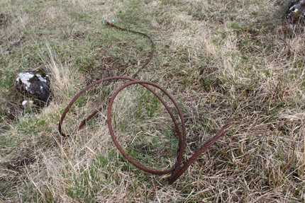
Long lengths of armoured cable are scattered across the site. (Martin Briscoe, April 2009) |
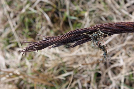
This doesn't look like WW2 cable. The coloured plastic sheathing is more like more modern communications cable. (Martin Briscoe, April 2009) |
 |
 |
More intriguing structures at the Loop Station. (Martin Briscoe, April 2009) |
(Martin Briscoe, April 2009) |
 |
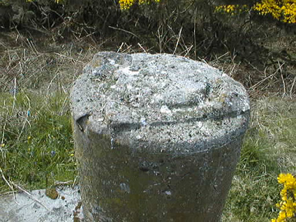 |
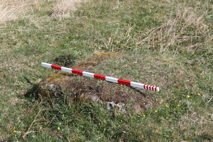
Concrete pillar at the top of the crevasse. This Position Finding Post (PF Post) indicates the site was an earlier practice battery, possibly the Argyll Mountain Battery, which had a section from Oban, or a later battery (see next column). (Martin Briscoe, 2000) |
The WW2 battery may have been the 204 Oban Battery of the Royal Artillery's 61st Artillery Tank Brigade (51st Highland Division). If anyone knows more about these PF Posts, pray tell. (Martin Briscoe, 2000) |
PORT WAR SIGNAL STATION
 |
 |
The Port War Signal Station received notice of ship movements from ships entering the area. This information was relayed by telephone down to the officer on duty in the Loop Control Hut 250 m away. That's Jim Allen in the photo. (Jim Allen, May 2006) |
View from the Port War Signal Station. The loop buildings are just off to the right in the distance and are about 250 m from the PWSS. The building in the centre is a private residence on the Dunollie Estate 100 m down the slope from the PWSS. It is the last house on the left before the loop station as you come from Oban. (Jim Allen, May 2006) |
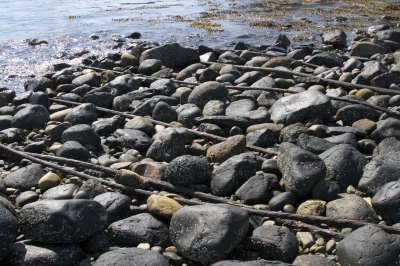
LOOP CABLE SAMPLES
Coming ashore at Gorten on Mull (see map
above) are some cables that are most likely WW2 "tail" cables for the No. 1 Indicator Loop.
The cables were photographed by Geoff Twibell. He describes them as follows:
There are some six steel-sheathed cables in all, three of them having frayed
down to the inner cores. One contains four rubber-covered cores - possibly "loop
tails". Another contains a single, larger core. The remaining cable is post WW2
and contains four PVC insulated cores one red, one blue and two white.
 |
 |
| The six armoured tail cables at Gorten | Gorten shoreline with hut in background. Cables run up this rocky shore. |
 |
 |
| Probable Indicator Loop "Tail" cables. See my Cablemakers webpage. Tail cables would have been Adm. Pattern 7048. | The telegraph hut - post WW2 |
R.A.F. BASE AT GANAVAN SANDS
At Ganavan Sands beach (on the north side of the headland where the loop huts were located) there was an RAF flying-boat base where maintenance and training was carried out. A hanger and several engineering sheds were built there to house the operations.
 |
 |
| Number 302 Ferry Training Unit based at Ganavan Sands | Ganavan Sands Caravan Park in 2001 |
The photo above on the left shows the Number 302 Ferry Training Unit based at Ganavan Sands where they trained crews to fly their aircraft over long journeys to such destinations as Africa, Asia and even Australia. The photo on the right is of the Ganavan Sands Caravan Park which held the site for many years until a new housing estate was built. Little remains of the RAF base, however, the steel runners of the hangar doors and the former generator shed may still be there. The indicator loop huts were on the headland at the rear of the photo. RAF Base image taken from Paul Burns' RAF Oban web page.
OBAN - MINEFIELD CONTROL TOWER
There is a minefield control tower at Gallanach overlooking the Sound of Kerra; it lies on the hillside on the south side of a caravan park. For more details, have a look at Nick Catford's photos and text on the Subterranea Britannica web site.
HELP!
If you know of other WW2 indicator loop stations around the world, please
contact me with
some of the details so we can correspond. I'm particularly interested in getting information from officers and ratings
who worked in the loop stations or laid the loop cables. Also, many scientists
were involved in the research at the Royal Navy's "Underwater Detection
Establishment". Are you still out there?
"Wren's Eye View"
The Adventures of a Visual Signaller by Stephanie Batstone.
Published by
Parapress Ltd, 5 Bentham Hill House, Stockland Green Road, Tunbridge Wells,
Kent. ISBN 1-898594-70-8. The first edition (1994) was revised and launched on
5th May 2001 with an
extra chapter added in which she describes the reunion with USN Signalman Jack
Campbell she got to know at Oban.
The following
extract talks about the loop station at Oban Bay (Little Ganavan Beach). The
author, Stephanie Batstone, was a 21 year old visual signaller working at the Royal Navy signal
station to the south. In a letter to me (8th September 2001) she said that she never actually saw the loop huts as
they were completely fenced off and quite invisible from the coast road and
from the signal station. She said no photos were taken of any of the huts:
'penalty of death I should think'. This extract is used with permission of the
author.
|
* Note: The green radar screen referred to above was most likely the Cathode Ray Oscilloscope screen for the Controlled Mining (which also used loop although they were usually called 'Guard Loops' or 'Mine Loops' - but worked on a similar principle. An indicator loop (without mines) more commonly used pen and ink to record a line on a continuous roll of paper about 8cm wide.
The photos and measurements in this webpage were taken by Martin Briscoe of Fort Williams, Inverness-shire, in 2000 and 2009. I'd like to thank Neil Owen of Oban for additional information and photos. The Royal Commission on the Ancient and Historical Monuments of Scotland (RCAHMS) has the Oban Indicator Loop Station (at Ganavan) on their Canmore database.