OF THE ROYAL NAVY IN THE NETHERLANDS
This is a small part of the story of the indicator loop station built during WW2 as part of the Royal Navy's anti-submarine harbour defences of The Schelde River, Netherlands. It is located between Walcheren Island and Nieuwe Sluis, 3 km west of the village of Breskens. Six Indicator Loops were laid in 1945 to detect German U-Boats. After the war the number of loops were increased to twelve.
 |
If you have any feedback please email me: Dr Richard Walding Research Fellow - School of Science Griffith University Brisbane, Australia Email: waldingr49@yahoo.com.au - or better still, contact the researcher
who provided all of the information on this page: |

LINKS TO SOME OF MY RELATED PAGES:
Indicator Loops around the World (Home Page) How an indicator loop works
With the surrender of the German garrison
on Walcheren Island, early November 1944, the operations to clear the Germans
from the riverbanks of the Scheldt were completed. Minesweeping commenced
but it was not until the end of the month that the first allied supply convoy
eneterd the port of Antwerp. The Germans understood the importance of Antwerp
and ordered their navy and airforce to bring the Thames-Scheldt convoy route to
a standstill. The German Navy made use of E-boats, the midget submarines
Biber, Molch and Seehund and a small surface vessel Linsen.
The Luftwaffe operated with Junker 88 aircraft to lay mines in the convoy
channel. The battle dragged on until the end of the war.
To counter this threat, RAF 85 Group, 2nd Tactical Airforce set up mobile radar
stations along the Belgian coast and on flooded Walchered. The Royal Navy
patrolled the river mouth with ASDIC (sonar) and depth charged where necessary.
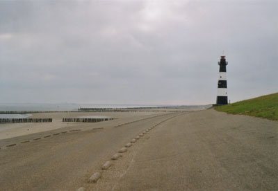
On the seabed between Flushing and Breskens high lighthouse (pictured below),
six anti-submarine indicator loops were laid to detect passing underwater craft.

 |
 |
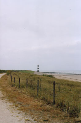
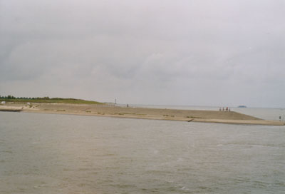
| The lighthouse at Nieuwe Sluis, looking East. This was the site of the Royal Navy antisubmarine Indicator Loop Control Hut. | A wider view showing Flushing. In the centre are some cranes which mark the location of the "De Schelde" shipyard which was there in WW2. |
 |
 |
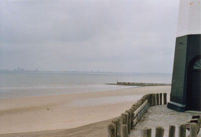
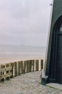
| Taken from the front door of the lighthouse with Flushing in the background (looking northeast). | Looking west in the direction of the North Sea. |
 |
|
Looking west with the lighthouse in the background. Taken from the pedestrian/bicycle ferry departing Breskens harbour back to Flushing. |
 |
 |
|
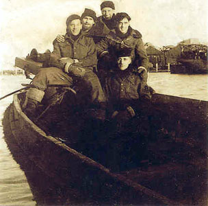
Royal Navy sailors off Breskens in January 1945 at the time when the loop station became operational. These men were responsible for laying the indicator loop cables and operating the control station. Sailor Charles Moulder is on the right (with his hands on the shoulders of the man in front). See below. |
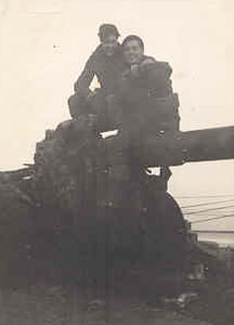
Charles Moulder (left) on a gun at Breskens in 1945. Photos supplied by his daughter Pam Rider. |
Code-name Nelly
The operations which ensued between December 1944 and May 1945 in the Scheldt Estuary are described in Code-name Nelly. The author Paul Crucq made use of the official records such as squadron Operation Record Books, debriefing reports, Navy records as well as documents from the Royal Artillery.
Specifications:
80 pages, 24cm x 33cm, hardcover, satin gloss paper, 45 recollections of
radar technicians, pilots, anti-aircraft personnel and civilians, 100
illustrations (photos and maps).
Contents:
Introduction
Chapter 1: Westkapelle Lighthouse & 'Nelly', December 1944.
Chapter 2: Operation Bodenplatte, January 1, 1945.
Chapter 3: The Midget Grows, 'Seehunde', January 1945.
Chapter 4: A New Radar at Oostkapelle 'Paddy', February 1945.
Chapter 5: UFOs and U-Boats over the Scheldt, March 1945.
Chapter 6: The Last Departures, April 1945.
Chapter 7: Goodbye to 'Nelly', 'Paddy' and 15081, May-July 1945.
It was a limited edition of 150 copies (English version), sold on a non-profit base. For the local market I produced a Dutch translation, mainly for the people in the village of Westkapelle where the RAF radar with the code-name 'Nelly' was set up on top of Westkapelle lighthouse. Paul still has copies of the Dutch translation in stock. Write to Paul Crucq, Veerseweg 110, 4332 BJ Middelburg, The Netherlands, or email pmcrucq@zeelandnet.nl